-
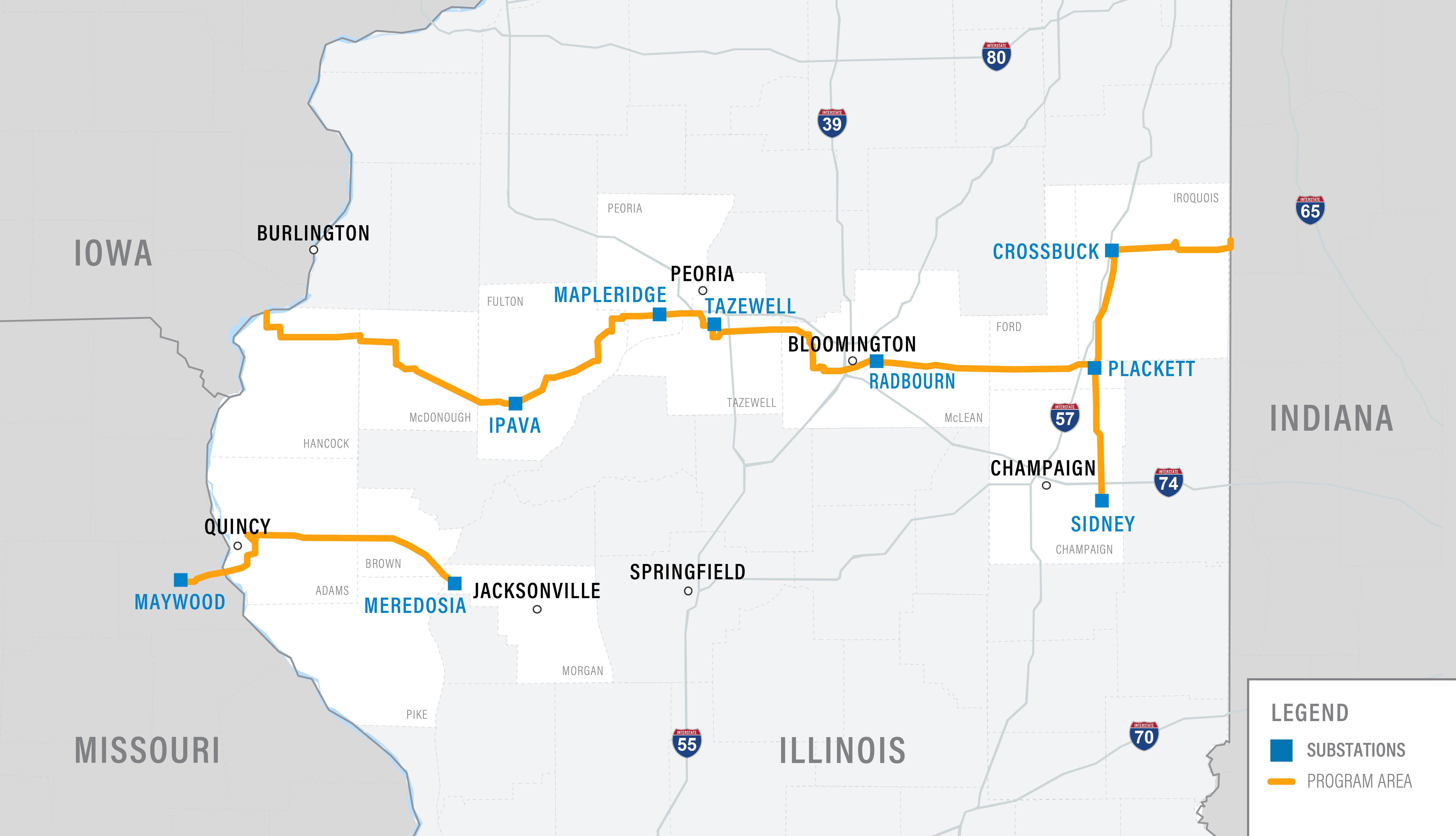
Approved Route
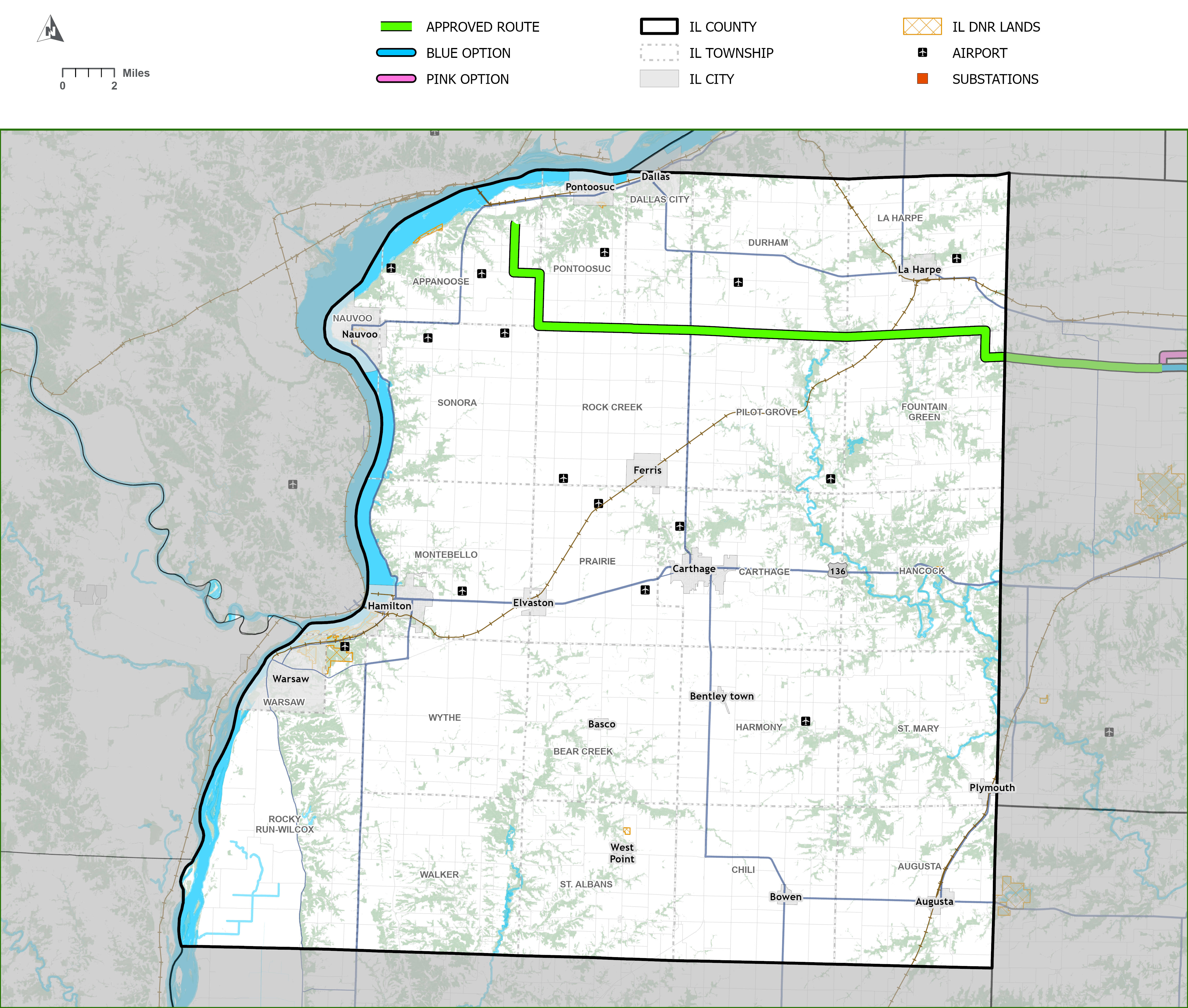
Hancock County
Real Estate Team
Contract Land Staff
Mailing Address:
210 South Randolph Street,
Macomb, Illinois 61455
tazewell_west@contractlandstaff.com
866 236 8897
Overview
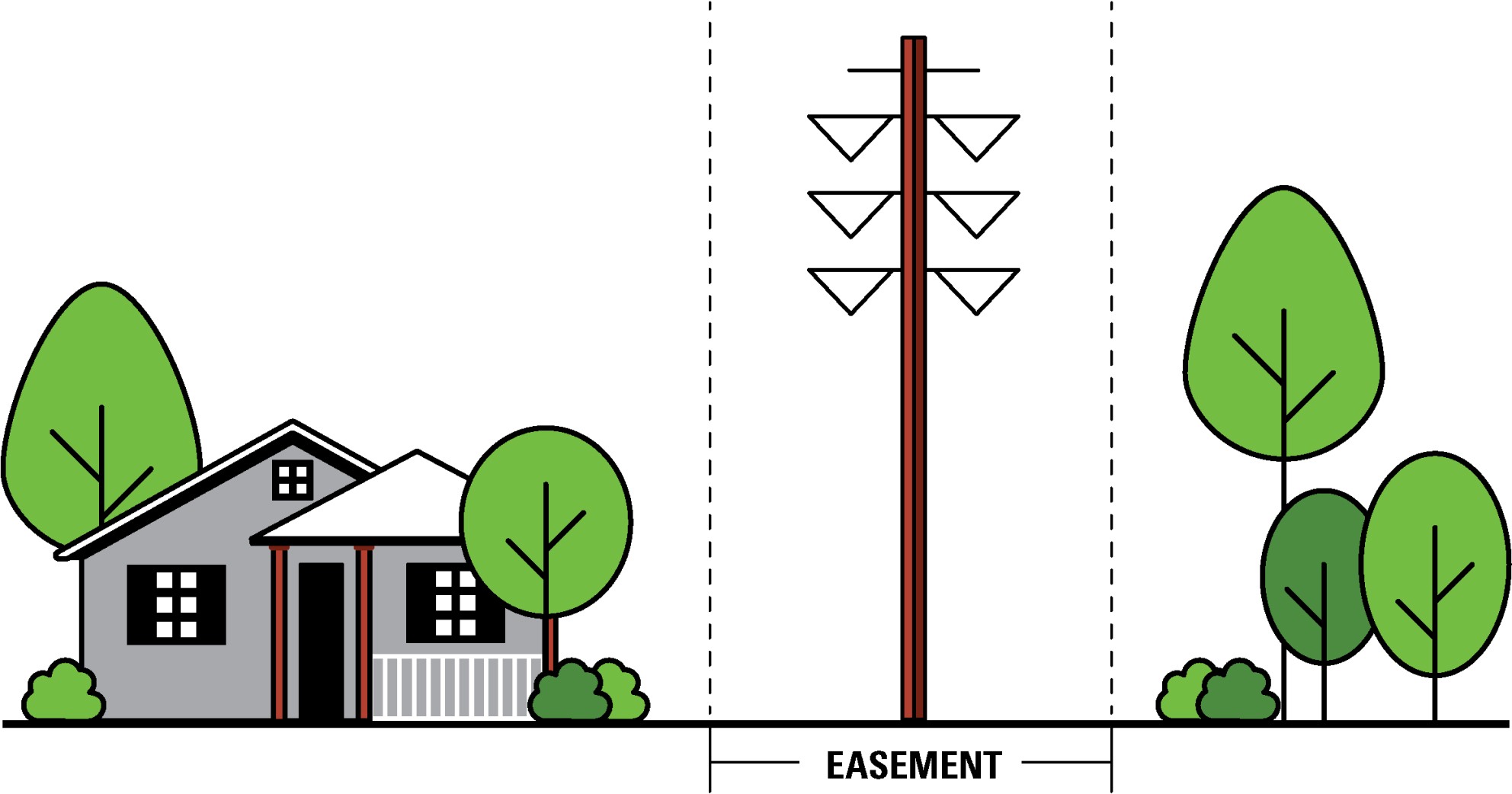
The Approved Route includes approximately 24 miles of upgraded transmission lines with the majority along existing corridors.
Click to enlarge
Download Mapbook (PDF)Structure Snapshot

Click to enlarge.
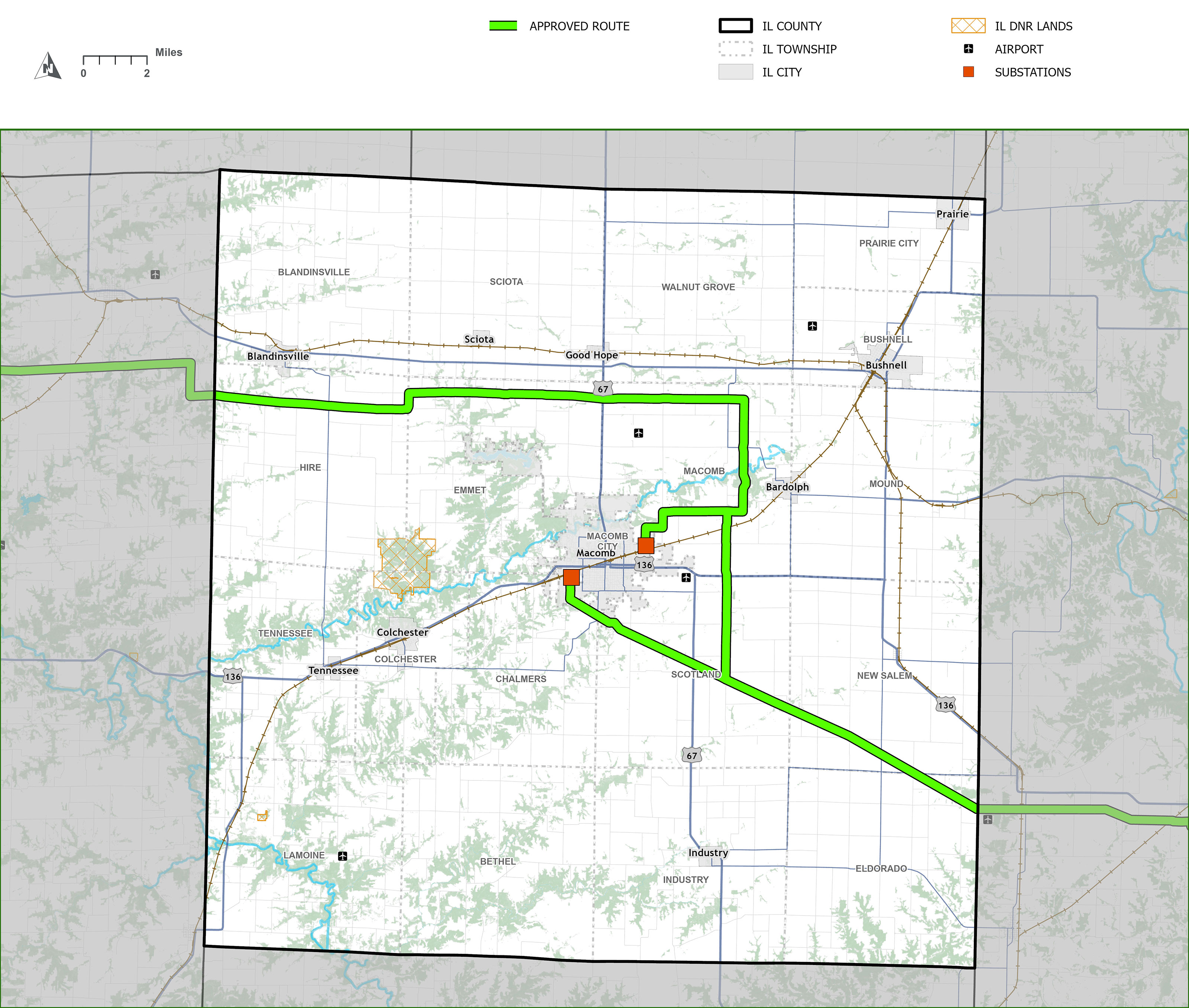
McDonough County
Real Estate Team
Contract Land Staff
Mailing Address:
210 South Randolph Street,
Macomb, Illinois 61455
tazewell_west@contractlandstaff.com
866 236 8897
Overview
The Approved Route has approximately 37 miles of new and upgraded transmission lines in McDonough County.
Click to enlarge
Download Mapbook (PDF)Structure Snapshot

Click to enlarge.
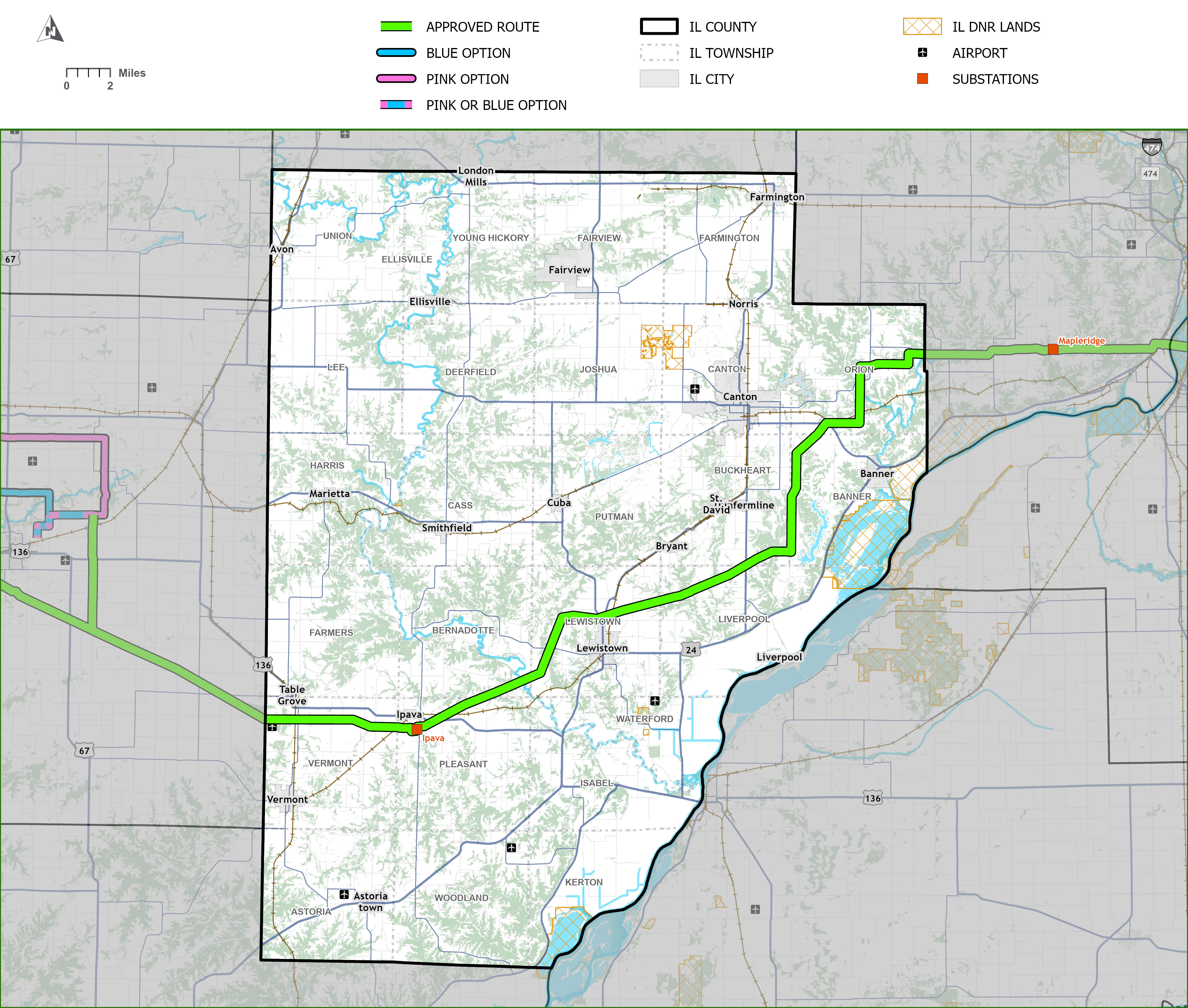
Fulton County
Real Estate Team
Contract Land Staff
Mailing Address:
210 South Randolph Street,
Macomb, Illinois 61455
tazewell_west@contractlandstaff.com
866 236 8897
Overview
The Approved Route has approximately 42 miles of upgraded transmission lines along existing corridors.
Click to enlarge
Download Mapbook (PDF)Structure Snapshot

Click to enlarge.
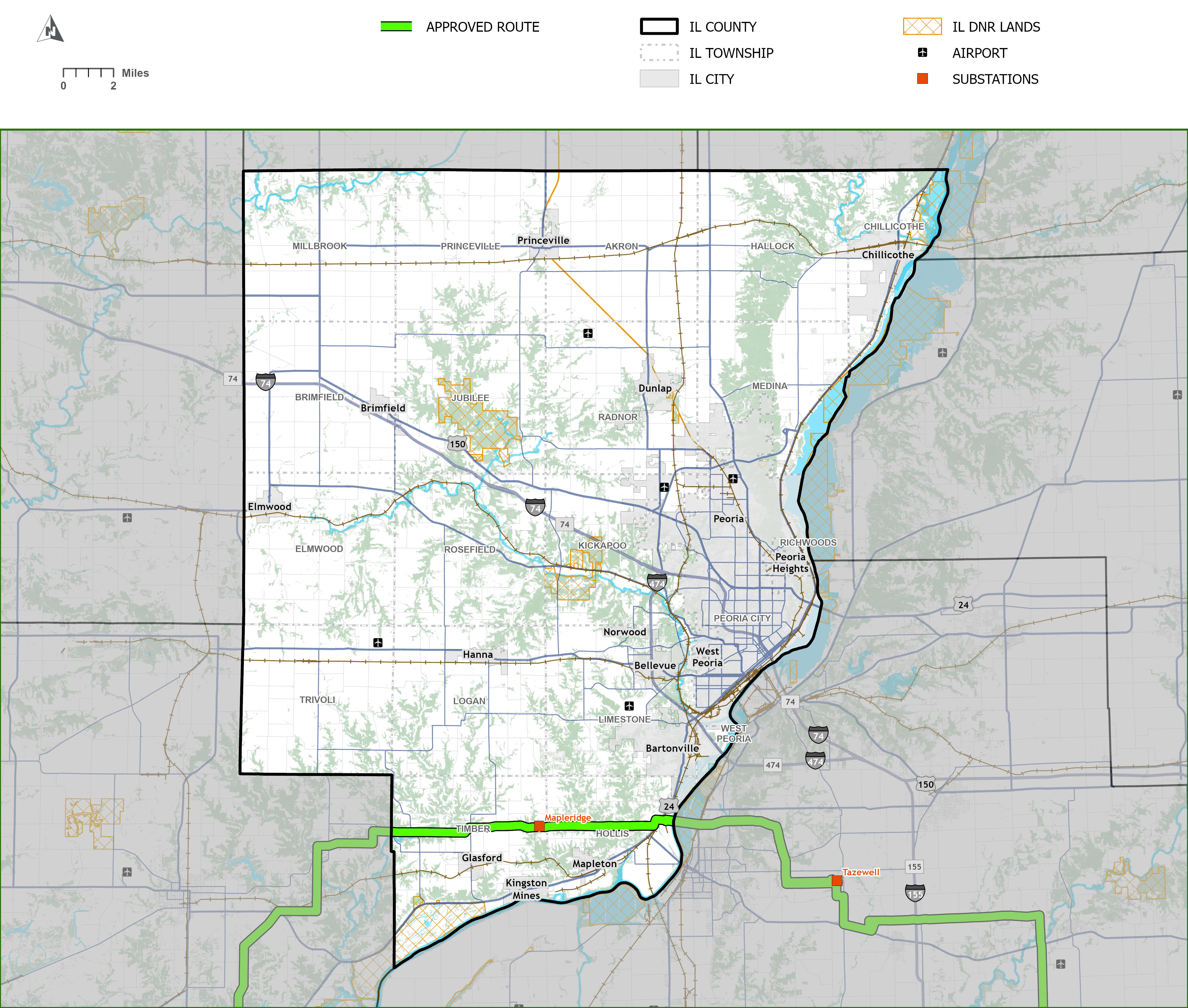
Peoria County
Real Estate Team
Contract Land Staff
Mailing Address:
210 South Randolph Street,
Macomb, Illinois 61455
tazewell_west@contractlandstaff.com
866 236 8897
Overview
The Approved Route has approximately 12 miles of upgraded transmission lines on existing structures to carry additional energy.
Click to enlarge
Download Mapbook (PDF)Structure Snapshot

Click to enlarge.
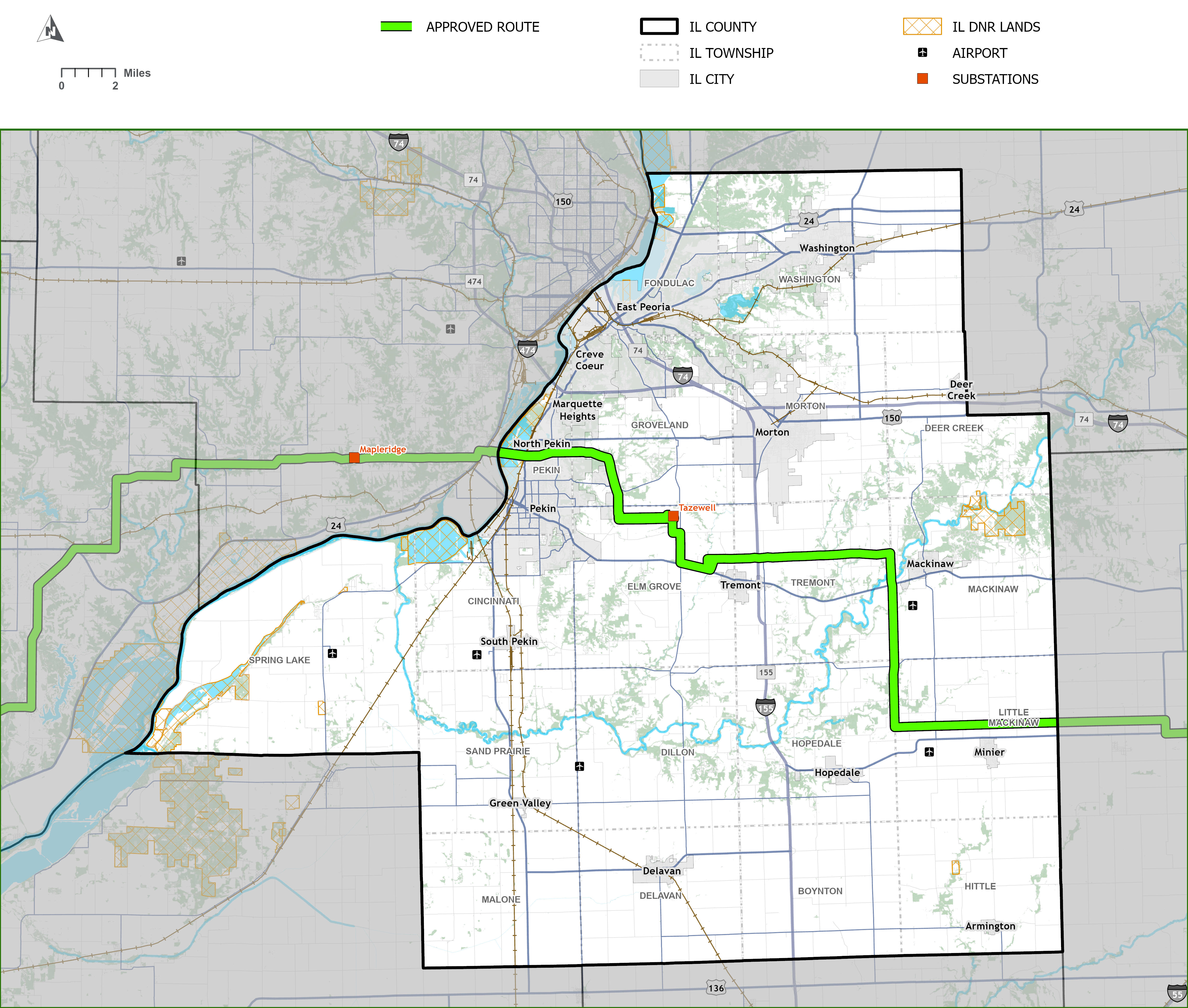
Tazewell County
Real Estate Team
Contract Land Staff
Mailing Address:
210 South Randolph Street,
Macomb, Illinois 61455
tazewell_west@contractlandstaff.com
866 236 8897
Overview
The Approved Route has approximately 40 miles of new and upgraded transmission lines in Tazewell County.
Click to enlarge
Download Mapbook (PDF)Structure Snapshot

Click to enlarge.
Tazewell County
Real Estate Team
Volkert
Mailing Address:
206 North Market Street
Paxton, Illinois 60957
TazewellEastRealEstate@volkert.com
833-665-3001
Overview
The Approved Route has approximately 40 miles of new and upgraded transmission lines in Tazewell County.
Click to enlarge
Download Mapbook (PDF)Structure Snapshot
Click to enlarge.
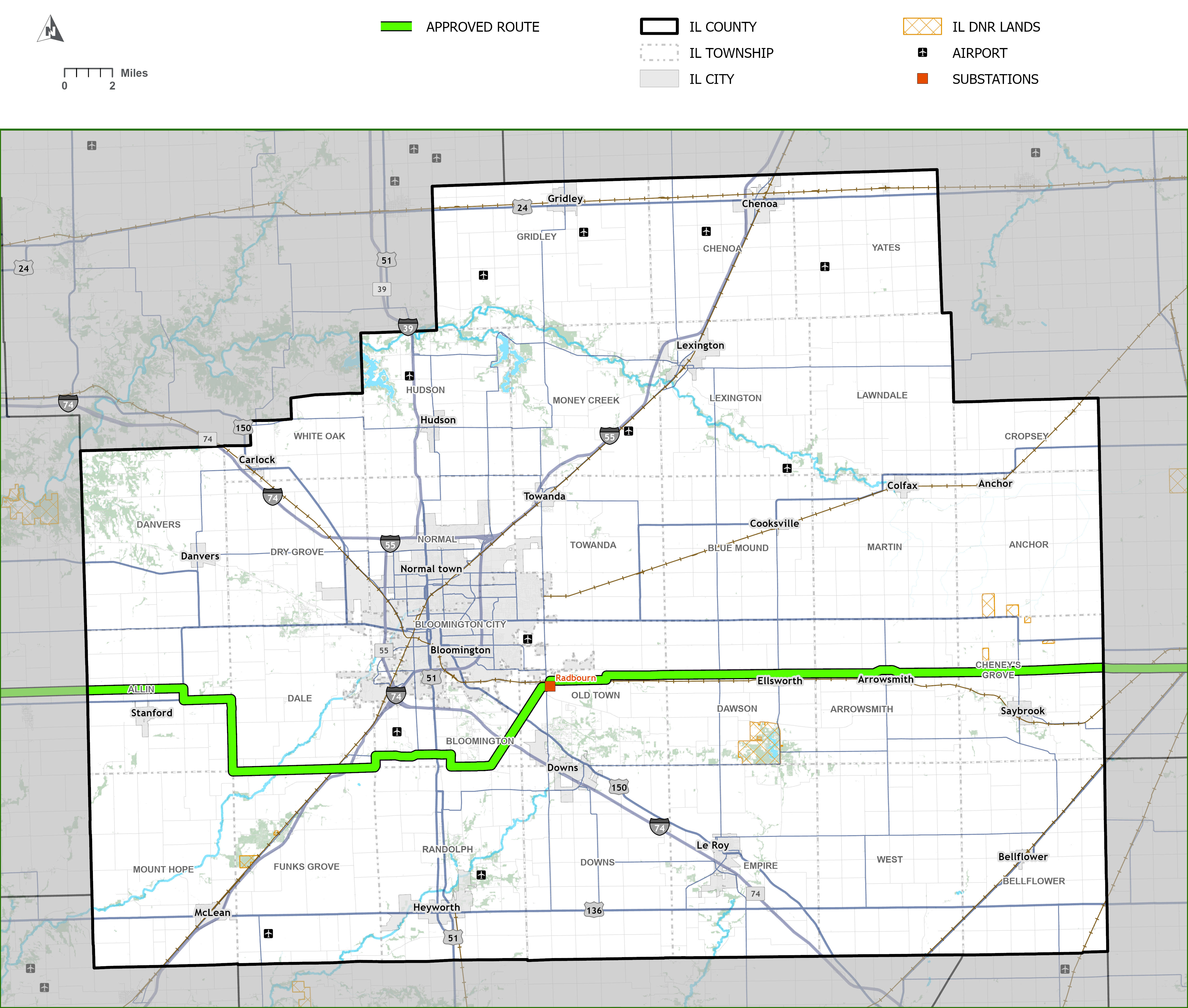
McLean County
Real Estate Team
Volkert
Mailing Address:
206 North Market Street
Paxton, Illinois 60957
TazewellEastRealEstate@volkert.com
833-665-3001
Overview
The Approved Route has approximately 50 miles of new and upgraded transmission lines in McLean County.
Click to enlarge
Download Mapbook (PDF)Structure Snapshot

Click to enlarge.
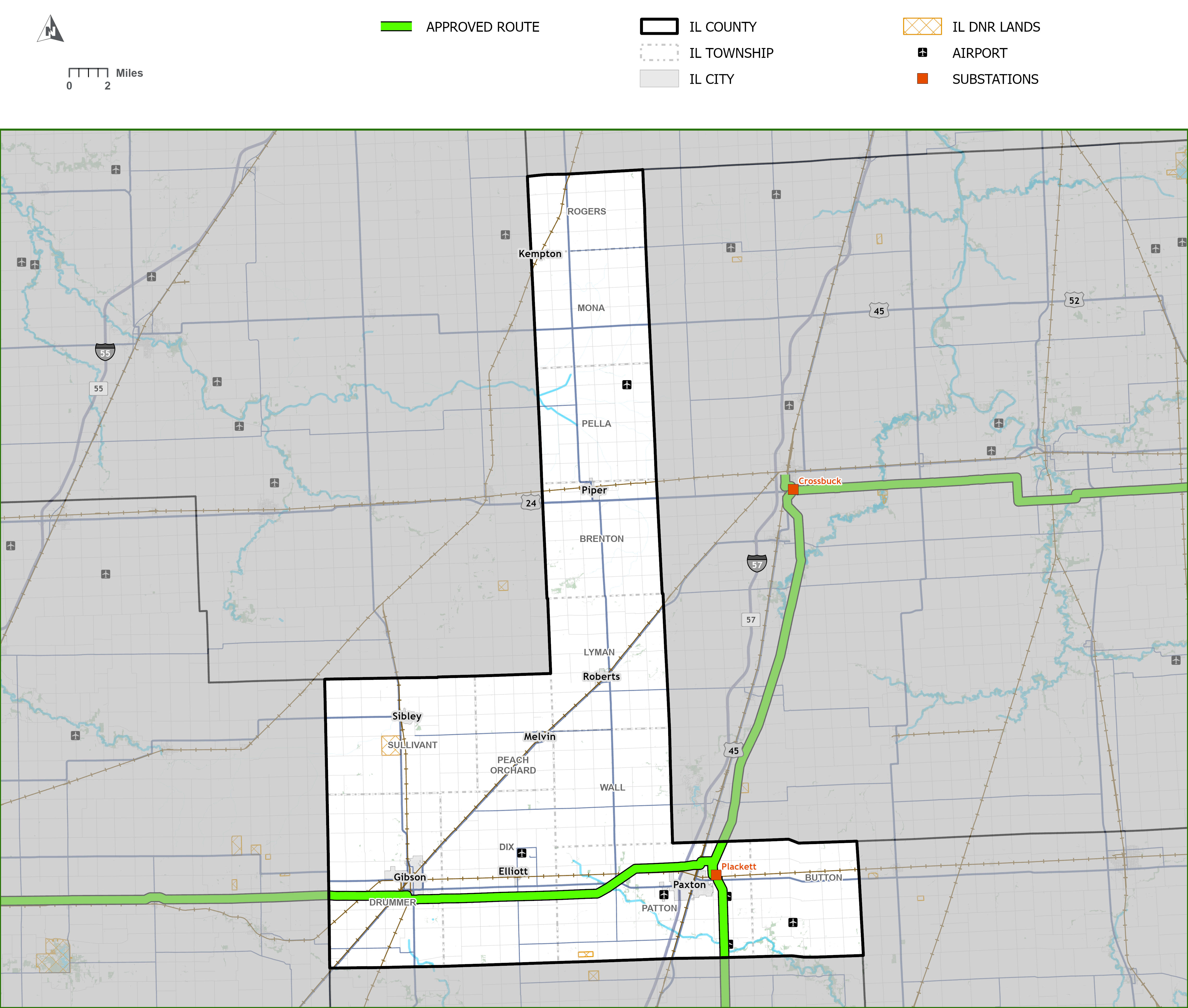
Ford County
Real Estate Team
Volkert
Mailing Address:
206 North Market Street
Paxton, Illinois 60957
TazewellEastRealEstate@volkert.com
833-665-3001
Overview
The Approved Route has approximately 27 miles of upgraded transmission lines with the majority along existing corridors.
Click to enlarge
Download Mapbook (PDF)Structure Snapshot

Click to enlarge.
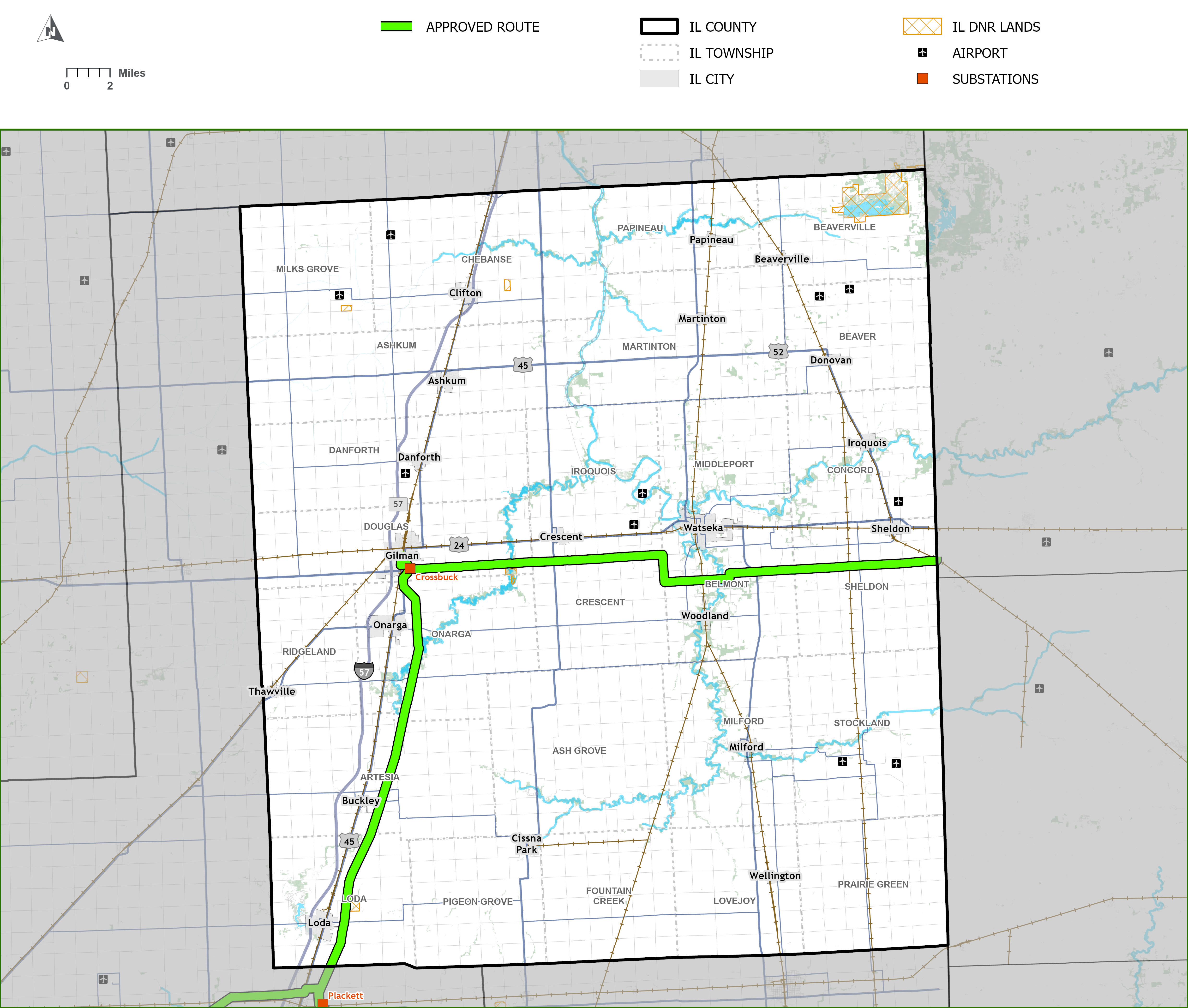
Iroquois County
Real Estate Team
Volkert
Mailing Address:
206 North Market Street
Paxton, Illinois 60957
TazewellEastRealEstate@volkert.com
833-665-3001
Overview
The Approved Route has approximately 50 miles of new or upgraded transmission lines with the majority along existing corridors.
Click to enlarge
Download Mapbook (PDF)Structure Snapshot

Click to enlarge.
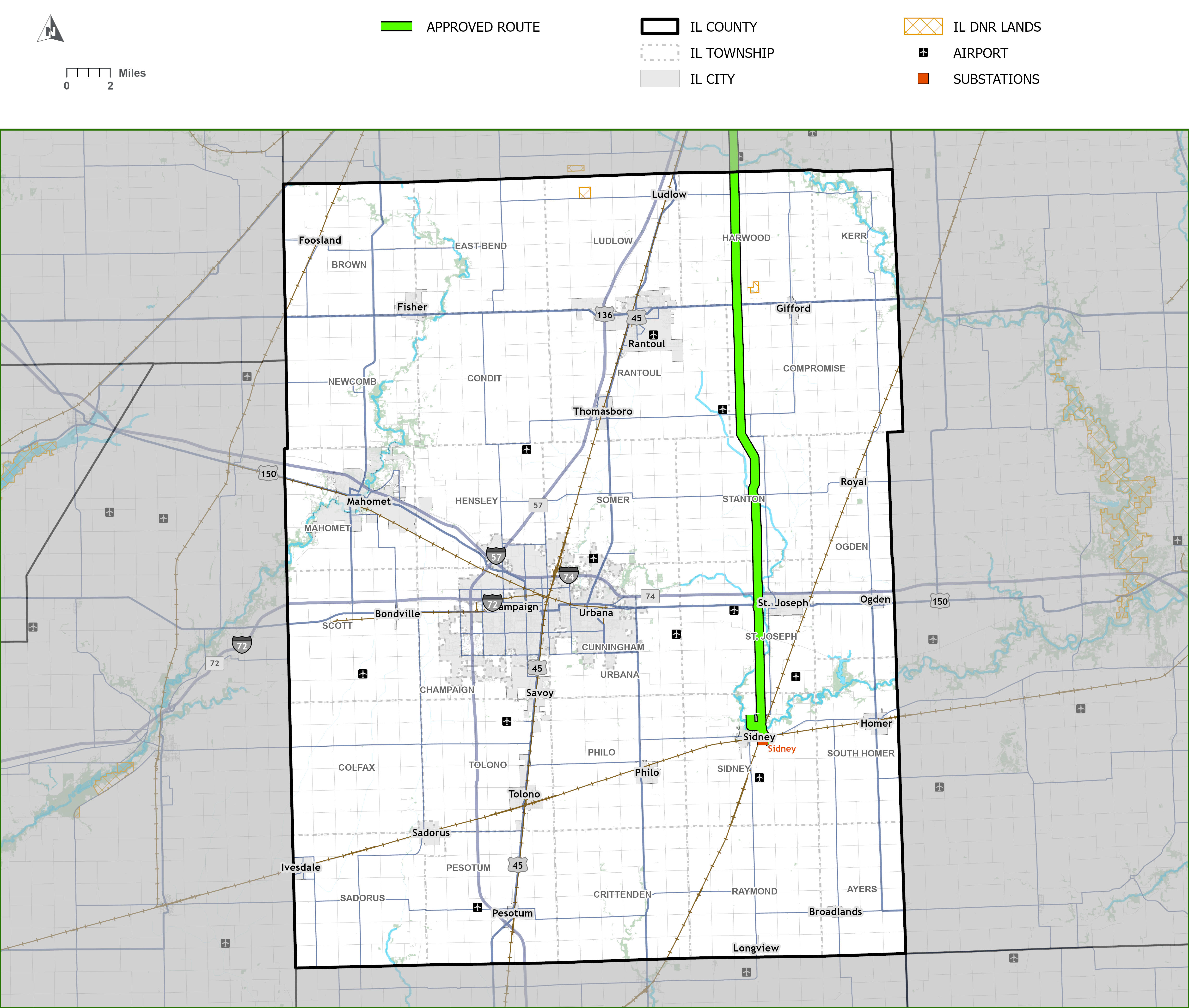
Champaign County
Real Estate Team
Volkert
Mailing Address:
206 North Market Street
Paxton, Illinois 60957
TazewellEastRealEstate@volkert.com
833-665-3001
Overview
The Approved Route has approximately 26 miles of upgraded transmission lines with the majority along existing corridors.
Click to enlarge
Download Mapbook (PDF)Structure Snapshot

Click to enlarge.
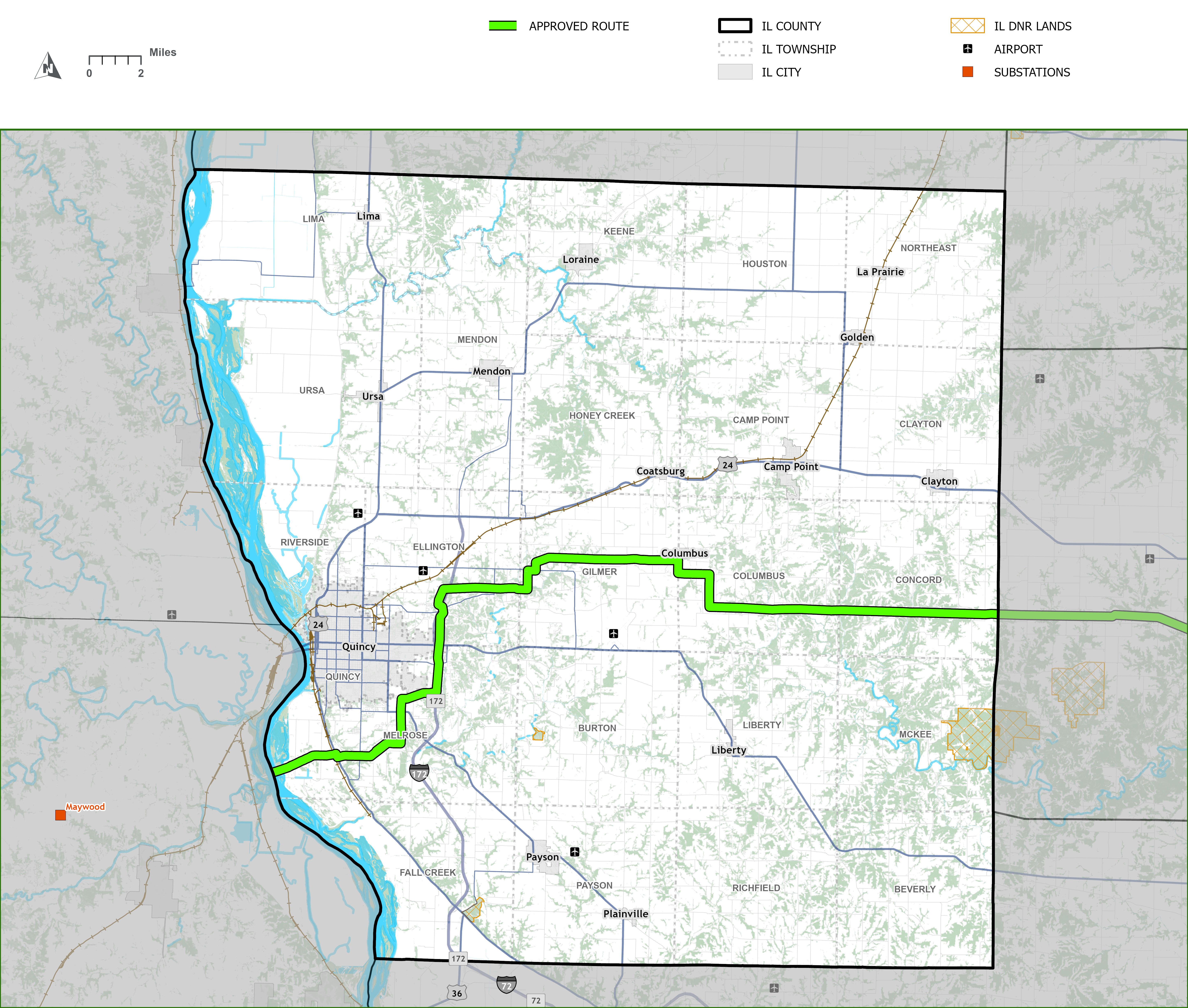
Adams County
Real Estate Team
Emerald Energy
Mailing Address:
14500 South Outer Forty Road, Suite 100,
Chesterfield, Missouri 63017
TazewellSouth@e3co.land
844-433-5263
Overview
The Approved Route has approximately 41 miles of new or upgraded transmission lines in Adams County.
Click to enlarge
Download Mapbook (PDF)Structure Snapshot

Click to enlarge.
Brown County
Real Estate Team
Emerald Energy
Mailing Address:
14500 South Outer Forty Road, Suite 100,
Chesterfield, Missouri 63017
TazewellSouth@e3co.land
844-433-5263
Overview
The Approved Route has approximately 20 miles of upgraded transmission lines with the majority along existing corridors.
Click to enlarge
Download Mapbook (PDF)Structure Snapshot

Click to enlarge.
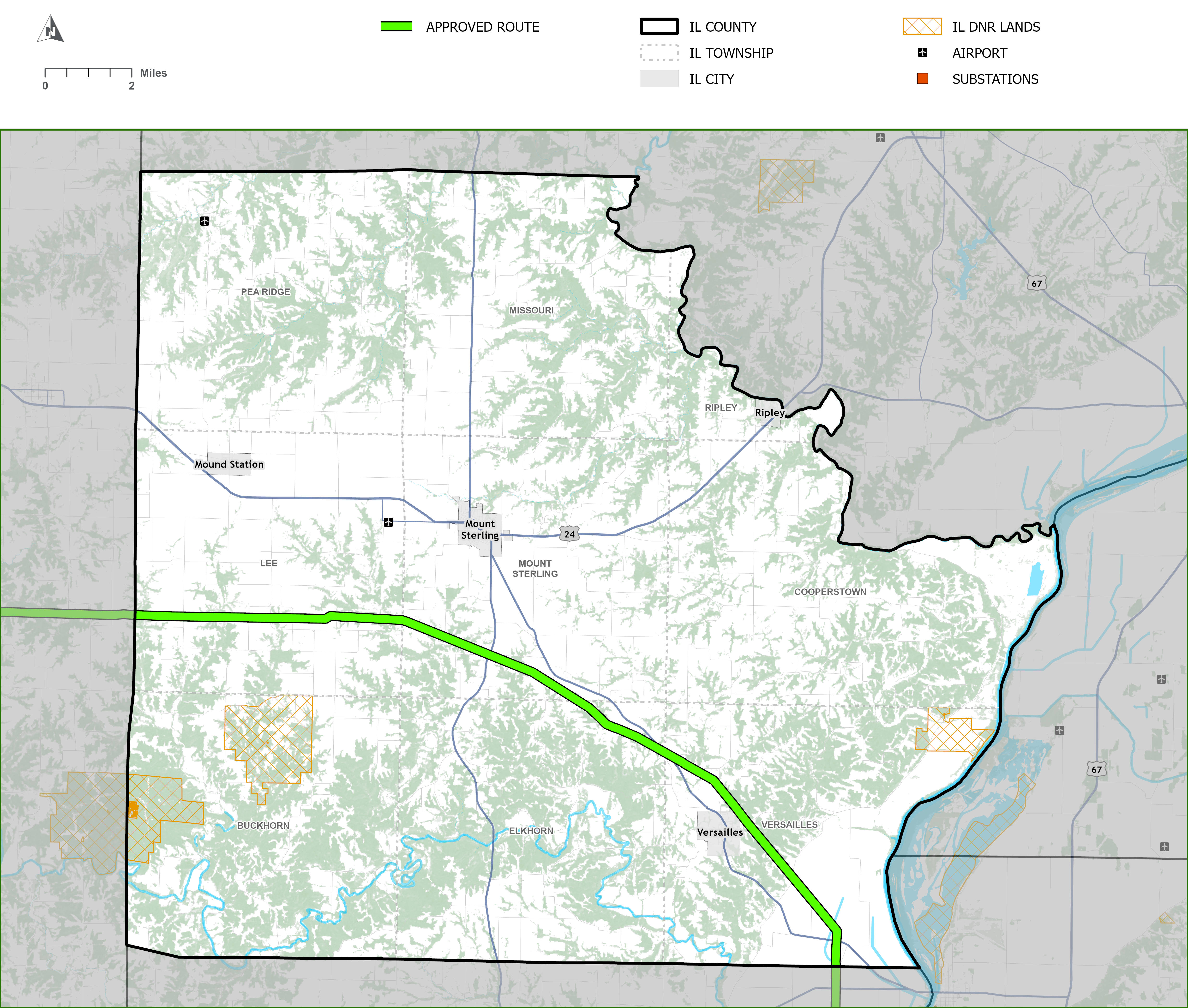
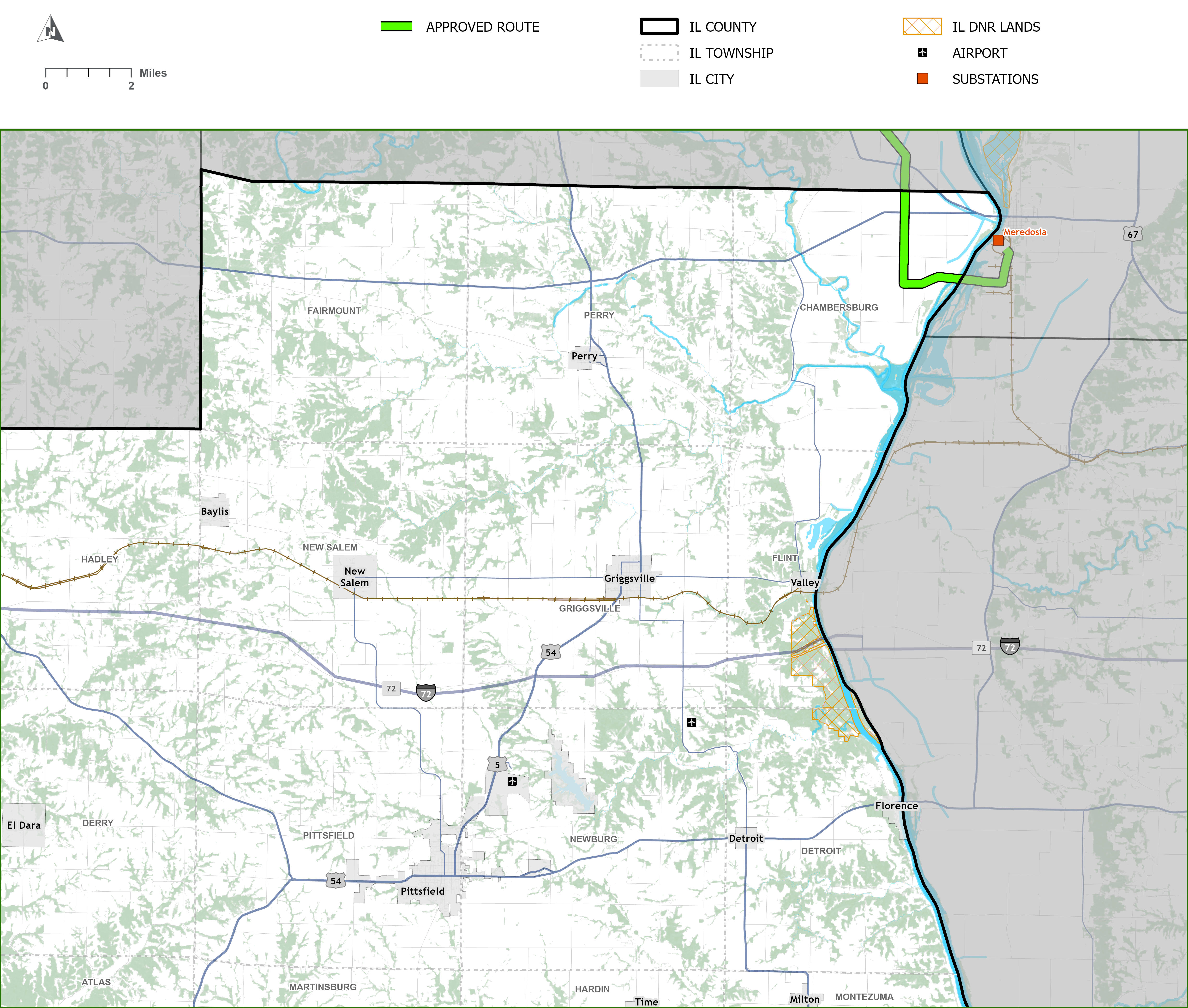
Pike County
Real Estate Team
Emerald Energy
Mailing Address:
14500 South Outer Forty Road, Suite 100,
Chesterfield, Missouri 63017
TazewellSouth@e3co.land
844-433-5263
Overview
The Approved Route has approximately 2 miles of new transmission lines. The new 345 kV circuit will be constructed in a new corridor to connect separate existing transmission corridors to utilize existing structures to cross the Illinois River.
Click to enlarge
Download Mapbook (PDF)Structure Snapshot

Click to enlarge.
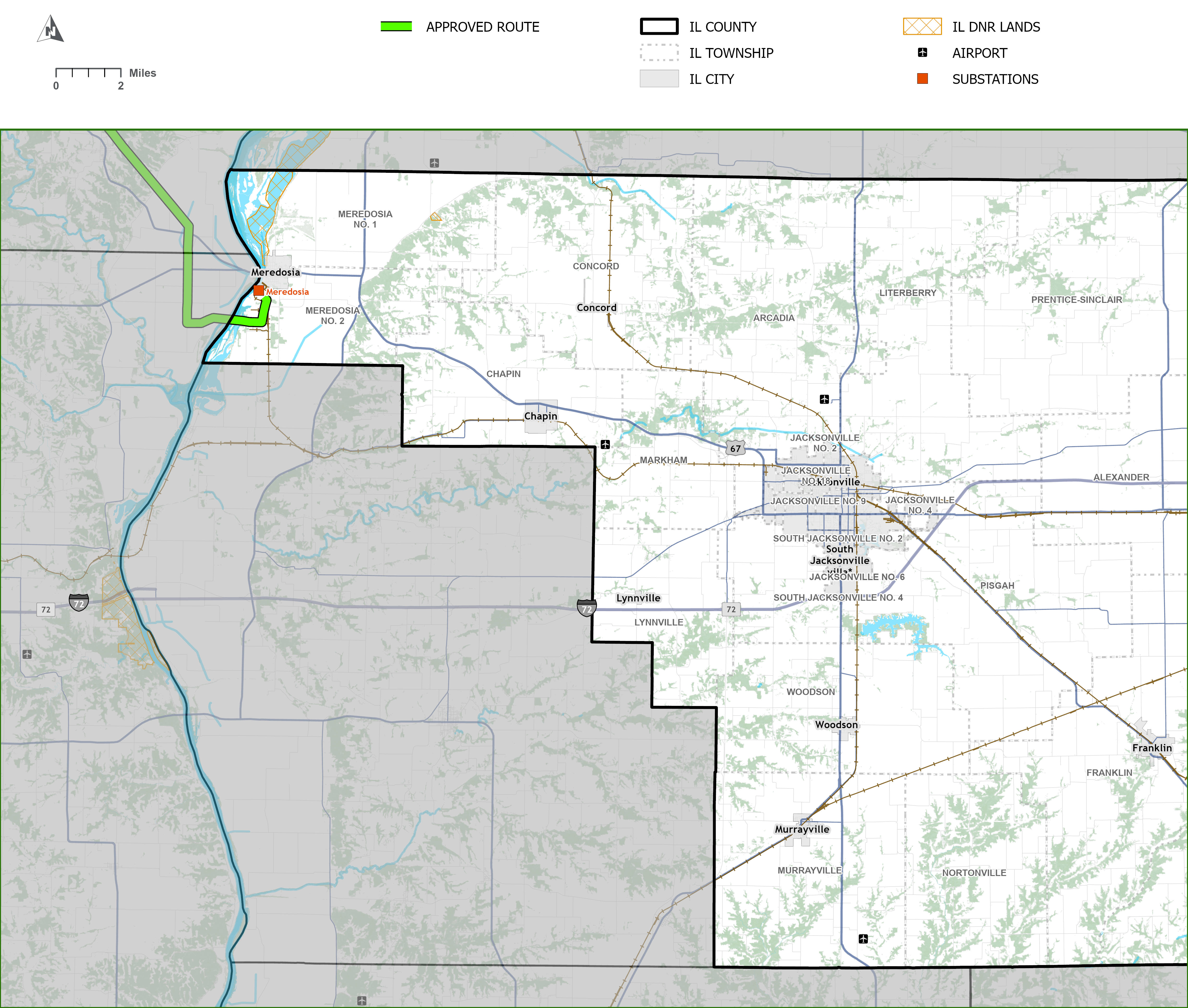
Morgan County
Real Estate Team
Emerald Energy
Mailing Address:
14500 South Outer Forty Road, Suite 100,
Chesterfield, Missouri 63017
TazewellSouth@e3co.land
844-433-5263
Overview
The Approved Route has approximately 2 miles of new transmission lines.
Click to enlarge
Download Mapbook (PDF)Structure Snapshot

Click to enlarge.


Illinois Commerce Commission Approves a Certificate and Route for the Program
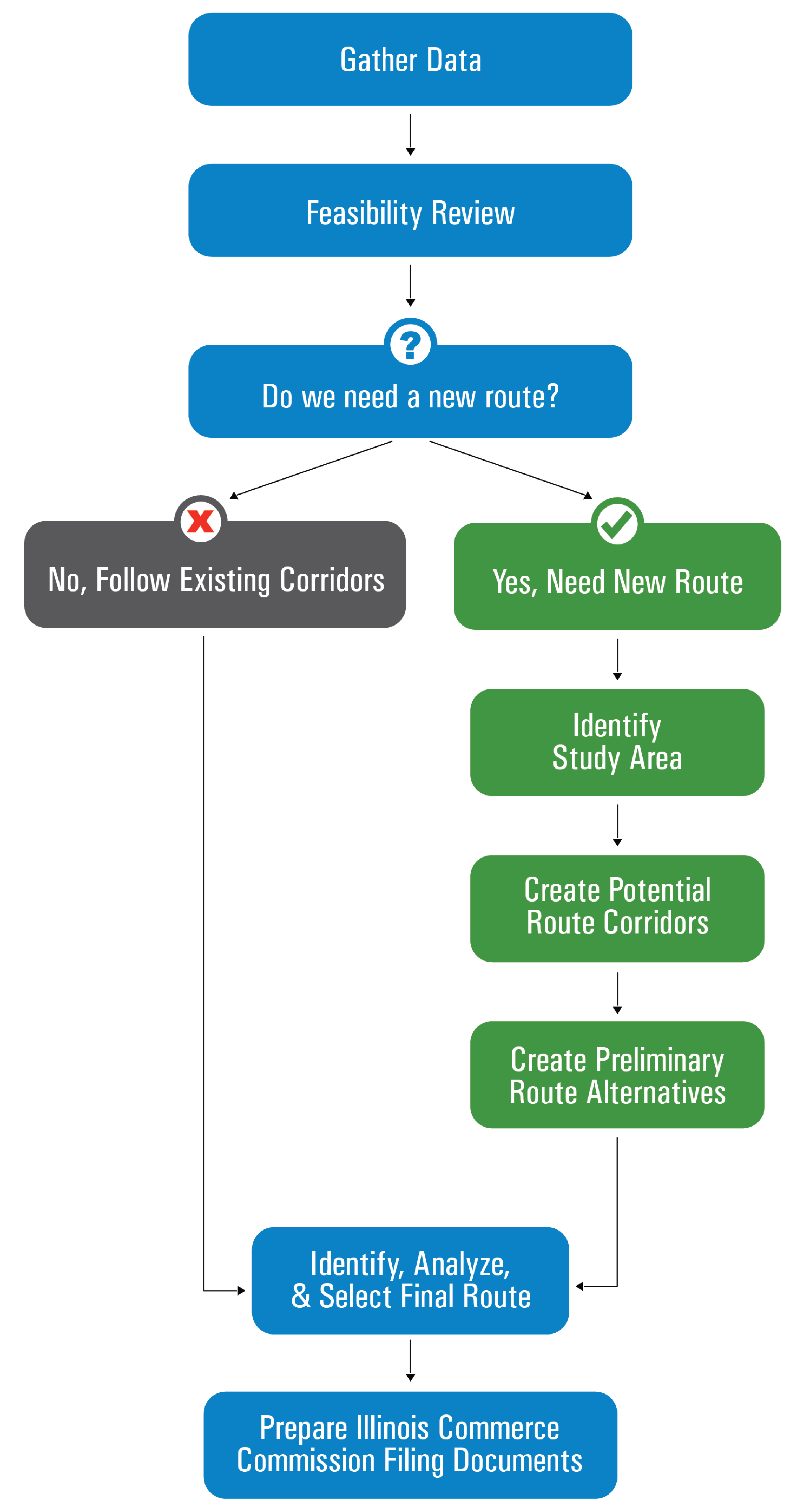
On February 5, 2024, ATXI and Ameren Illinois jointly submitted an application to the Illinois Commerce Commission (ICC) for a Certificate of Public Convenience and Necessity for the Program.
On July 2, 2025, the ICC issued a Final Order and CPCN and approved a route that includes options in Adams and McDonough counties (the Approved Route). In early 2026, the final route options were selected in Adams and McDonough counties. The team is now working with affected landowners and stakeholders to develop the Program in those areas.
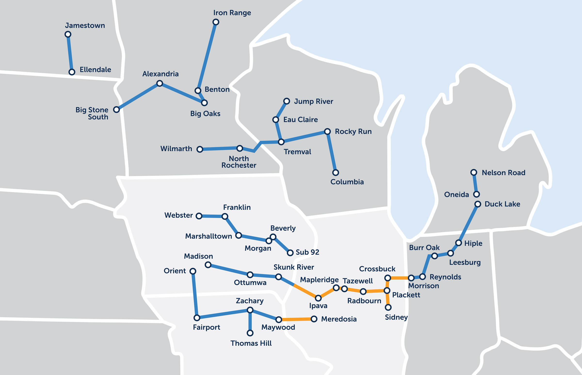
View the Approved Route and click or tap on the icons on the left to learn more about the Program.