-
Orange Route Option
-
Purple Route Option
-
Existing 138kV upgrade to 138/345kV
-
Existing Option
-
Pink Route Option
-
Blue Route Option
-
Yellow Connector
-
IL County
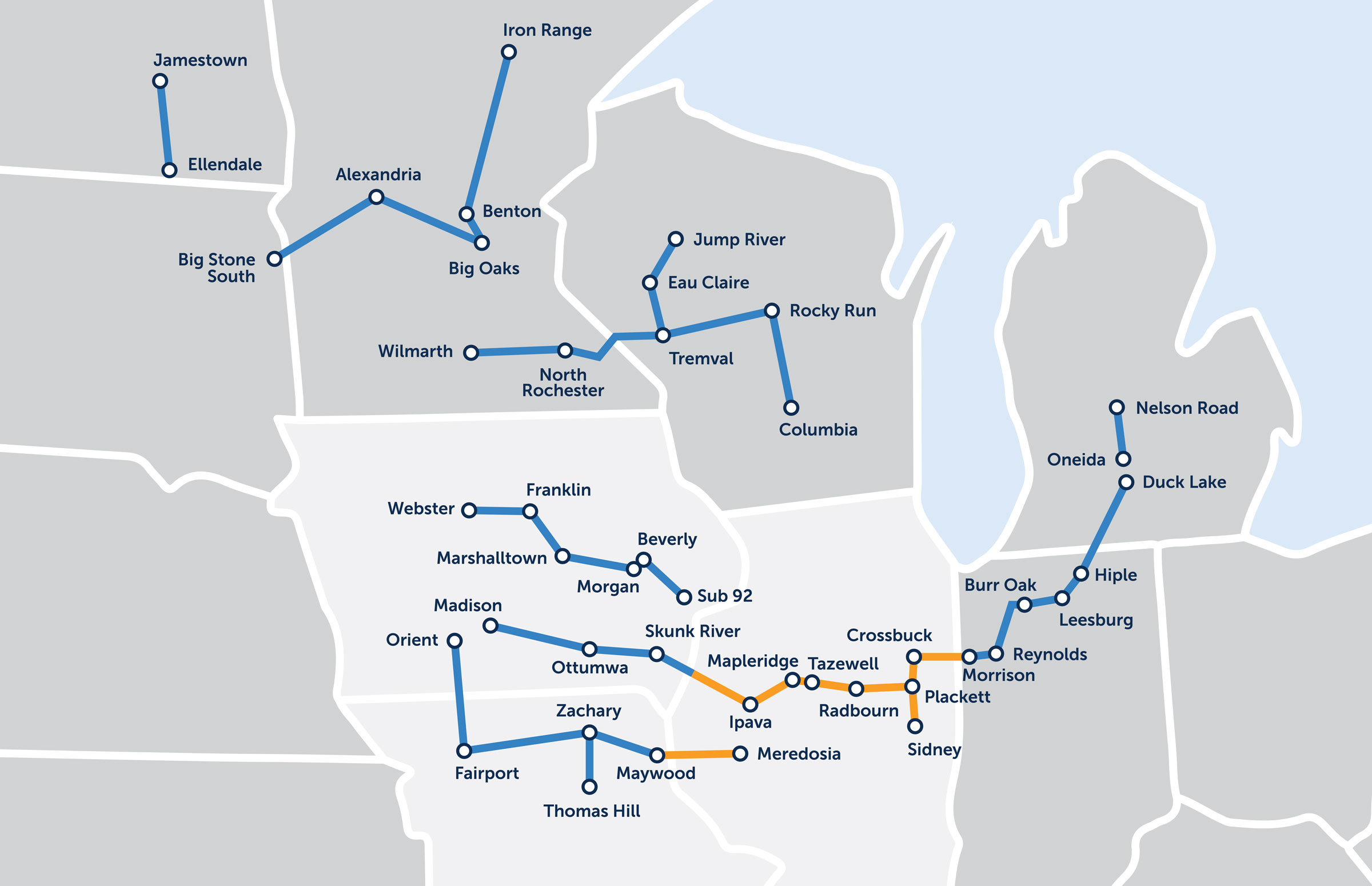
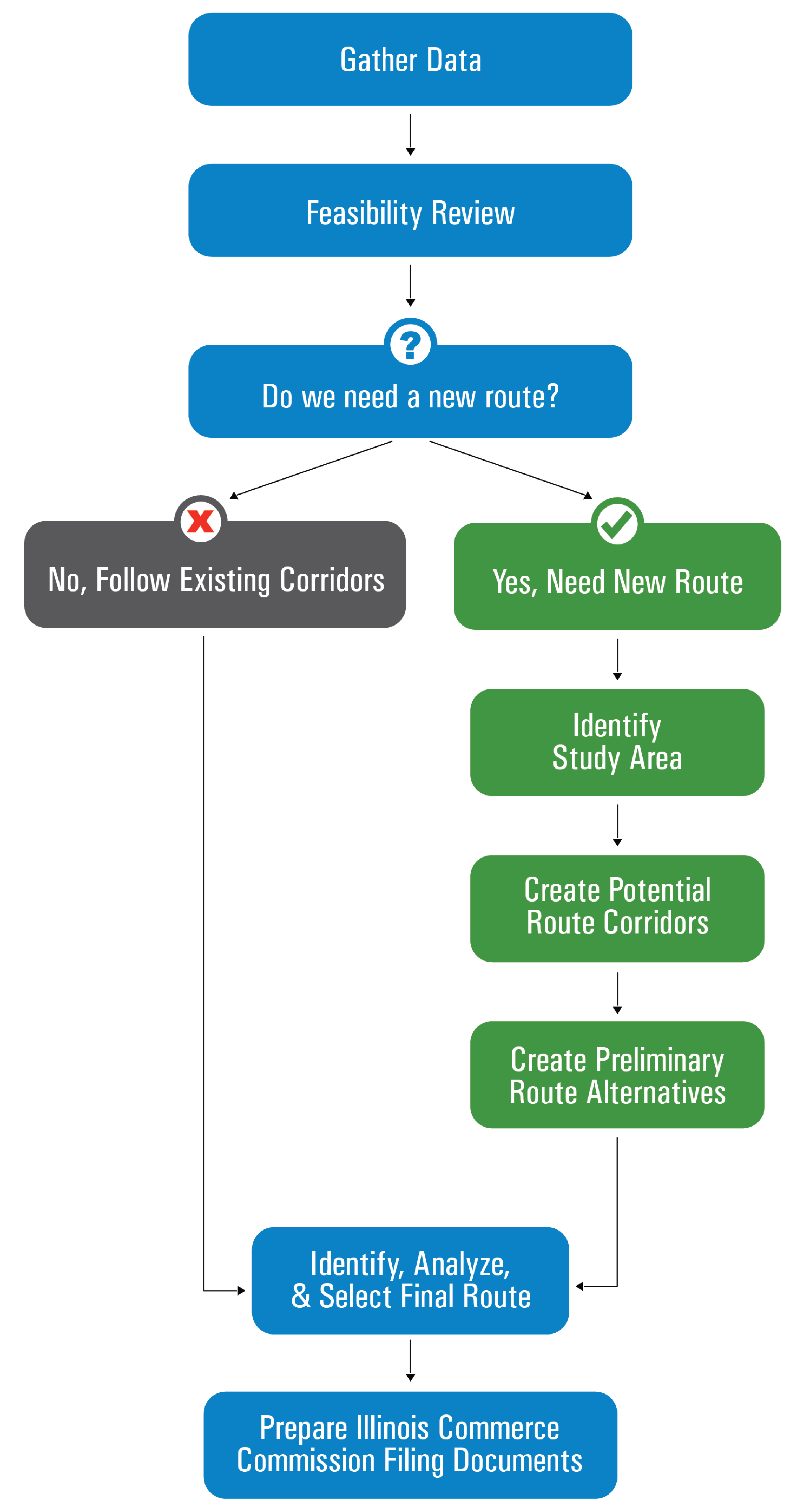
The colors on the map are different routes our team is exploring as part of the routing process. We will only be constructing one of these routes for the line. However, it is possible that the final routes could be combination of routes. We are sharing these preliminary route alternatives with the public to gather valuable input and feedback on the opportunities and sensitivities that will help our team in the routing process. Click on your county on the map to learn more.
Hancock County
Open House
Wednesday, October 11
11:00am - 1:00pm or 5:00pm - 7:00pm
Lake Hill Winery, Carthage
Routing in Hancock County
In general, we are following existing corridors in this area. The orange line on the map below is another potential option we are exploring instead of following the existing corridor in the northwest corner of the county.

Click to enlarge
Download Mapbook (PDF)Overview
There are approximately 24 miles of upgraded transmission lines in Hancock County.

Click to enlarge
Replacement
Replacing 24 miles of existing wooden monopoles with new steel monopoles to carry additional energy. In most instances, the number of structures is lessened with a smaller footprint due to design and longer spans. New structures will typically be constructed within existing corridors.
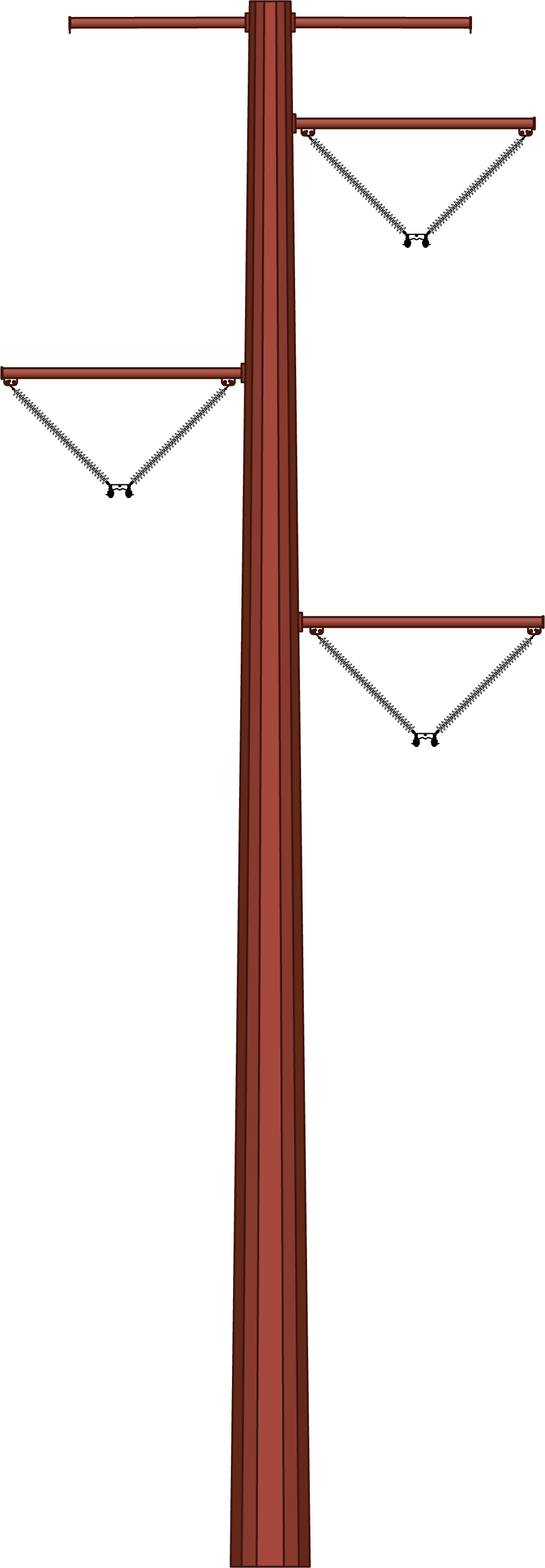
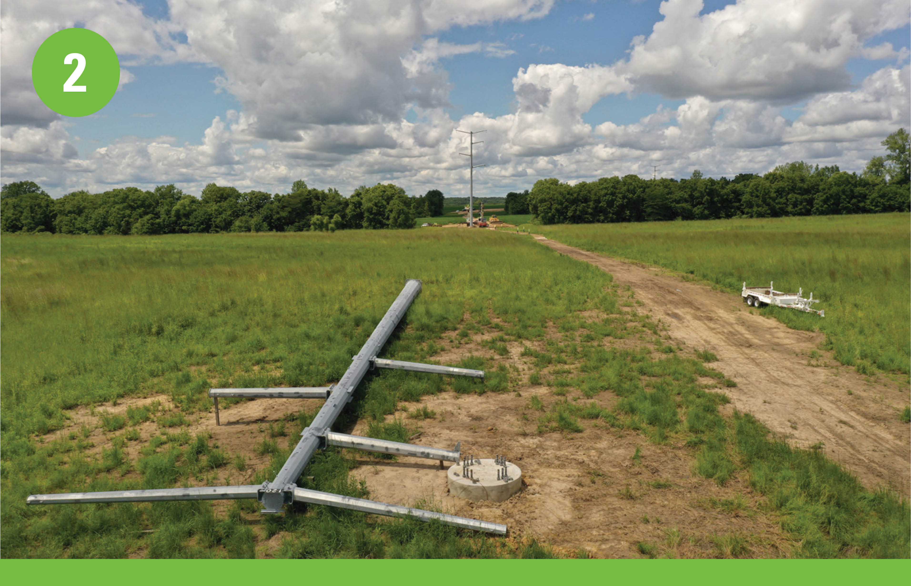
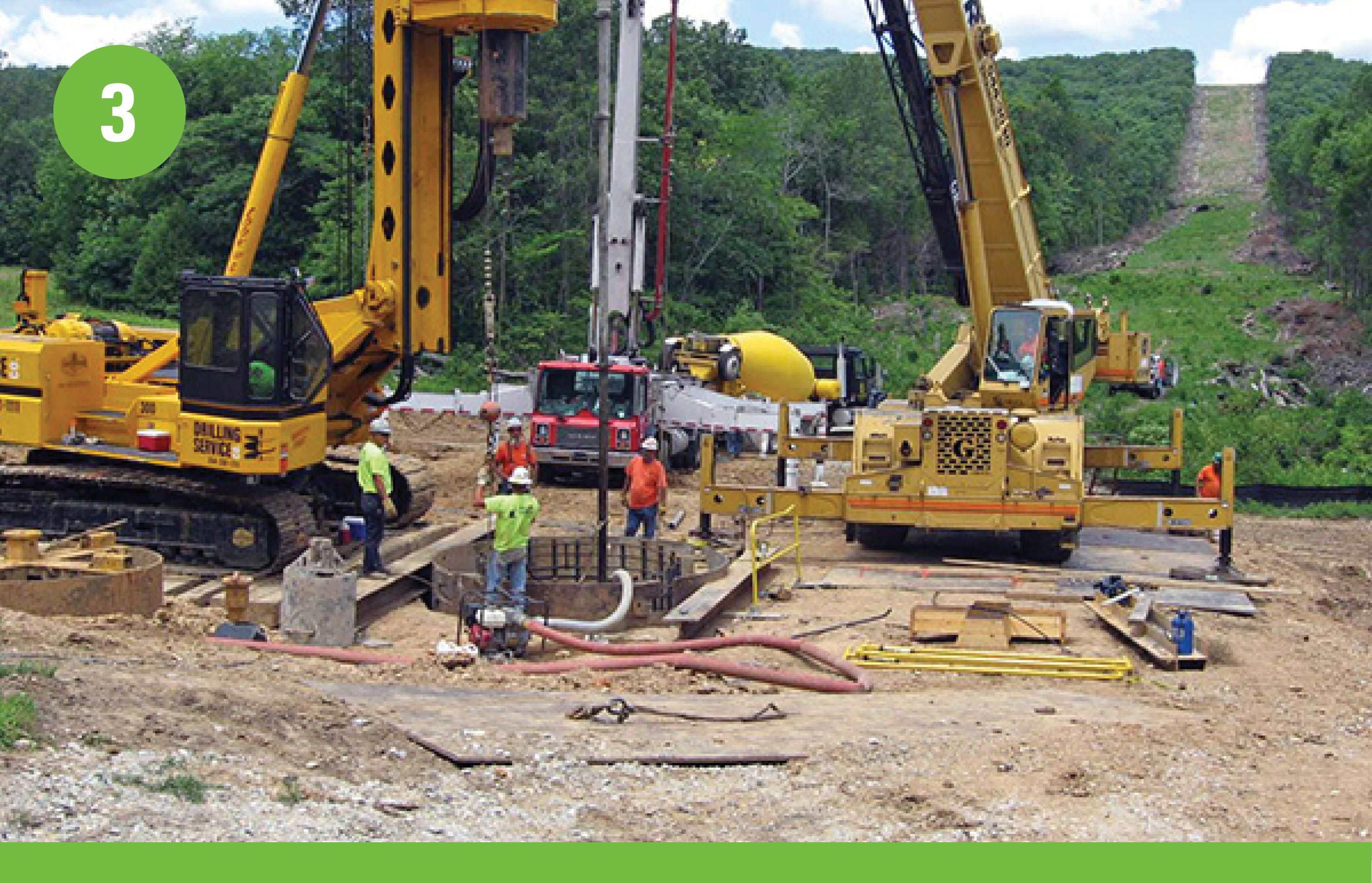
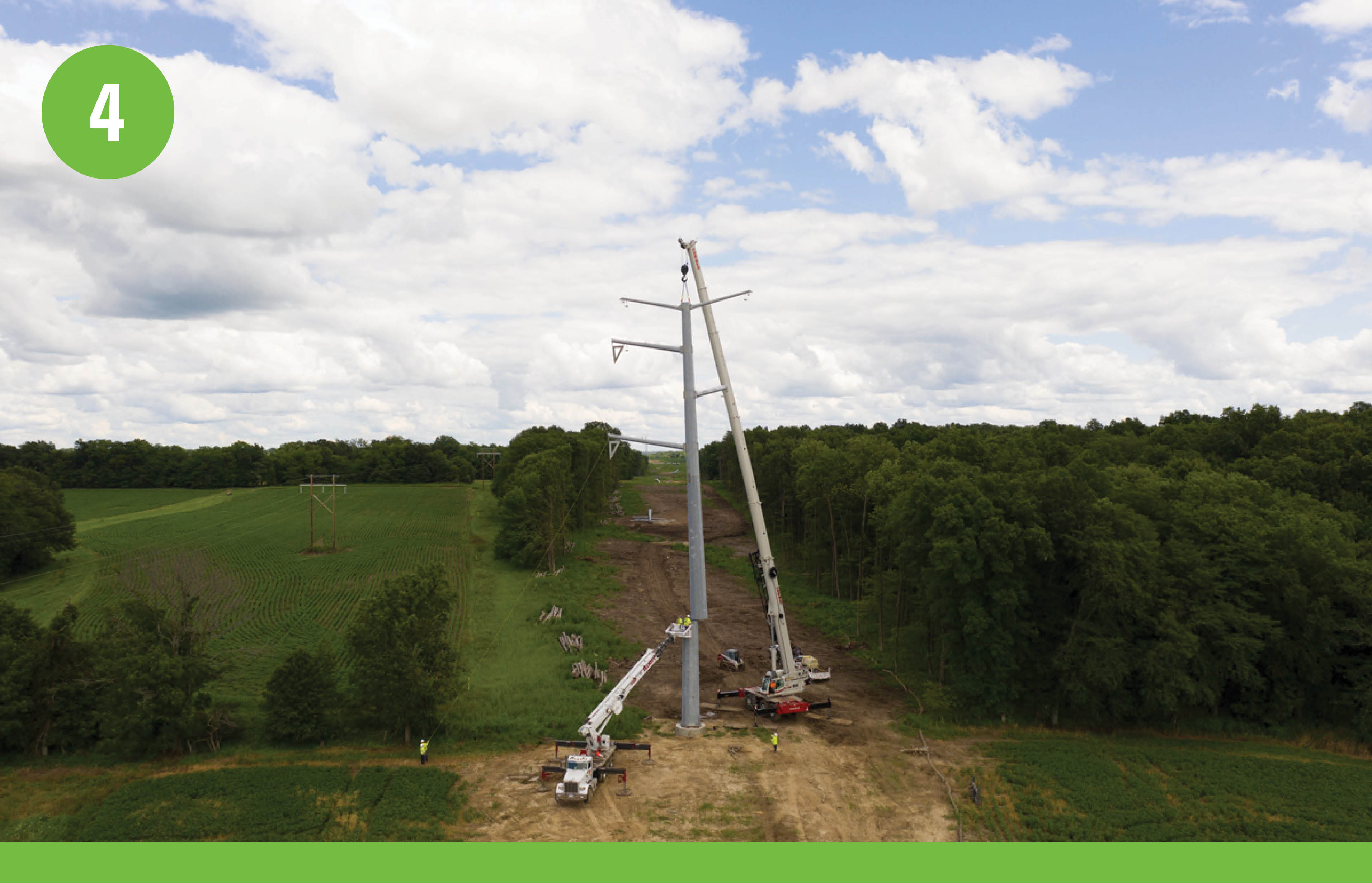
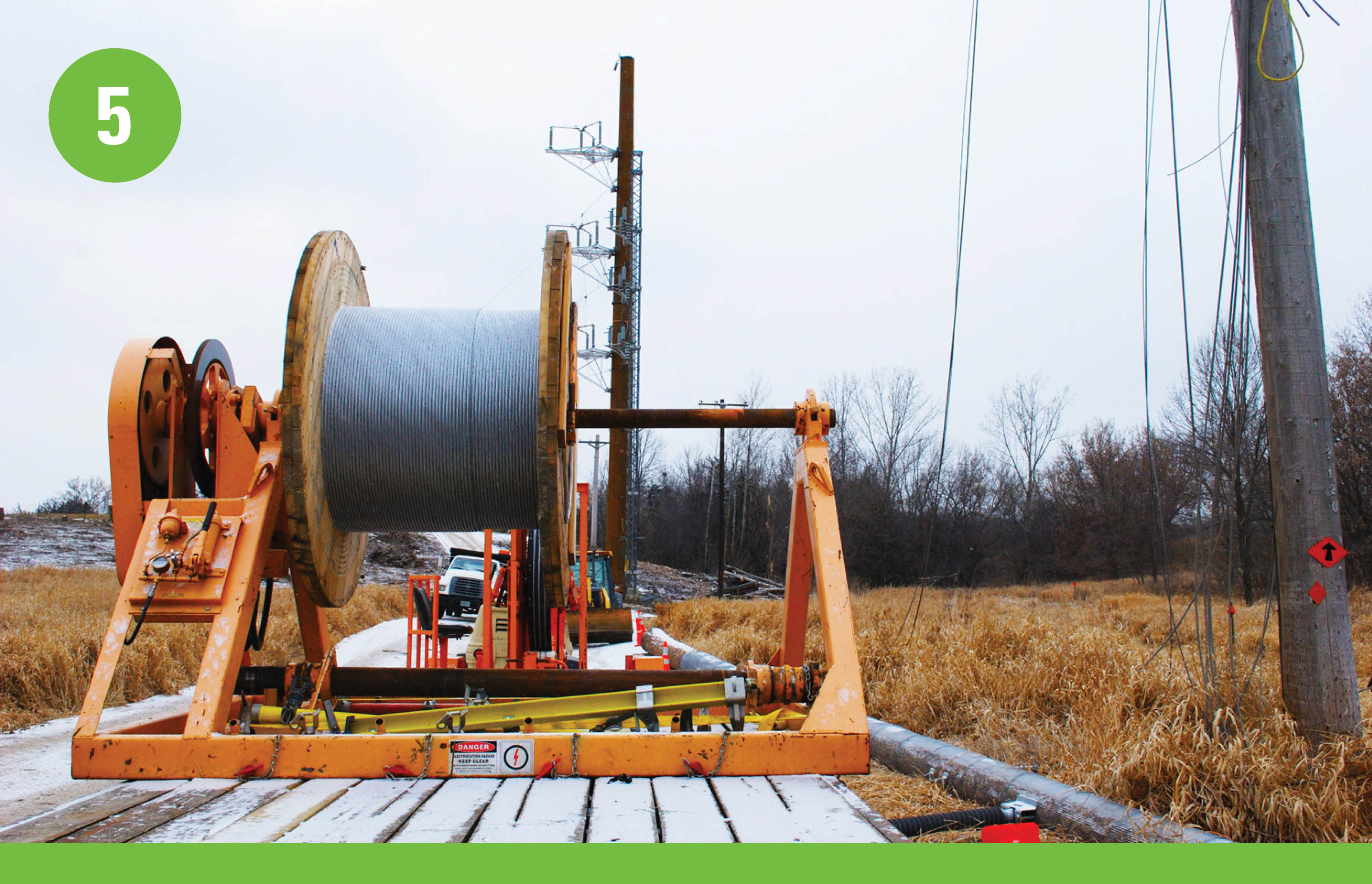
Structure Snapshot
Click to enlarge.
McDonough County
Open House
Tuesday, October 10
11:00am - 1:00pm or 5:00pm - 7:00pm
Spoon River College Outreach Center
Routing in McDonough County
Listen to an update about what's happening in McDonough County.
Hello! My name is Drew Beahm. I am one of the project managers for the Central Illinois Grid Transformation Program. We appreciate your interest in the program in McDonough County. I’m sure you’re wondering what all the different lines on this map are for. Using our routing criteria, as well as input received from stakeholders and community members during phase 1 of public engagement, our team developed more defined routes or “Preliminary Route Alternatives”. We are sharing these preliminary route alternatives with the public to gather valuable input and feedback on the opportunities and sensitivities that will help our team in the routing process.
The colors on the map are different routes our team is exploring as part of the routing process. We will only be constructing one of these routes for the line. However, it is possible that the final routes could be combination of routes.
The yellow lines on the map are called connectors. Connectors are additional options the routing team is reviewing that could potentially be part of the final route. These connectors will only be used if they are selected as the final Preferred Route.
The dark green lines along the western and eastern sides of the county represent existing single circuit 138 kV transmission lines that will be replaced with new double circuit, steel monopole structures that will carry the new 345 kV circuit and existing 138 kV circuit.
Along the central portion of the County, the configuration of, and congestion along the existing transmission corridors requires the team to consider new corridors, of which multiple options have been identified.
Let’s start with the purple and orange routes. If either of these routes are selected, we would build a new, 345kV single circuit line around the city and rebuild the existing 138kV circuit along the light green line through the city. These two lines would then connect back up in the southeast of Macomb.
e have a few different options on the north side of the city. The first option is to rebuild the existing 138kV circuit – the light green line on the map – where it currently is through the city of Macomb. In this scenario, a new, single circuit 345kV transmission line would be built along the blue or pink route around the city. These two lines would then connect back up in the southeast of Macomb.
The second option is to relocate the existing 138kV circuit – the light green line on the map – that currently runs through the city and build a new, 138kV and 345kV double circuit on either the blue or pink routes on the map. This option would also require constructing 138 kV connector lines along blue, yellow, or green lines into the existing substations that currently serve the Macomb area.
Now that you’ve learned more about what the colored lines mean, we encourage you to go back to the main map page and provide any feedback or input that would be helpful for our team to know during the routing process.

Click to enlarge
Download Mapbook (PDF) Routing Process Overview (PDF) What we Heard in McDonough County (PDF)Overview
There are approximately 37 miles of new and upgraded transmission lines in McDonough County.

Click to enlarge
Replacement
Replacing 14 miles of existing wooden monopoles and H-frame structures with new steel monopoles to carry additional energy. In most instances, the number of structures is lessened with a smaller footprint due to design and longer spans. New structures will typically be constructed within existing corridors.
New Corridor
The new 345 kV circuit will be routed approximately 19 to 24 miles along new corridors through the county. The new structures may be constructed as single-circuit 345 kV or as double circuit with the existing 138 kV circuits being relocated into the new transmission corridors.
Structure Snapshot
Click to enlarge.
Fulton County
Open House
Thursday, October 12
11:00am - 1:00pm or 5:00pm - 7:00pm
Cuba Community Center, Cuba
Routing in Fulton County
We are following existing corridors in this area.

Click to enlarge
Download Mapbook (PDF)Overview
There are approximately 42 miles of upgraded transmission lines in Fulton County.

Click to enlarge
Replacement
Replacing 28 miles of existing wood and lattice H-frame structures with new steel monopoles to carry additional energy. In most instances, the number of structures is lessened with a smaller footprint due to design and longer spans. New structures will typically be constructed within existing corridors.
New Wire
Adding new wire to 14 miles of existing structures to carry additional energy.
Structure Snapshot
Click to enlarge.
Peoria County
Open House
Tuesday, October 10
11:00am - 1:00pm or 5:00pm - 7:00pm
Bartonville American Legion Post 979
Routing in Peoria County
We are adding or replacing wire on existing lattice structures to carry additional energy.

Click to enlarge
Download Mapbook (PDF)Overview
There are approximately 12 miles of upgraded transmission lines in Peoria County.

Click to enlarge
New Wire
Adding new wire to 6 miles of existing lattice structures to carry additional energy.
Replace Wire
Replacing wire on 6 miles of existing lattice structures to carry additional energy.
Structure Snapshot
Click to enlarge.
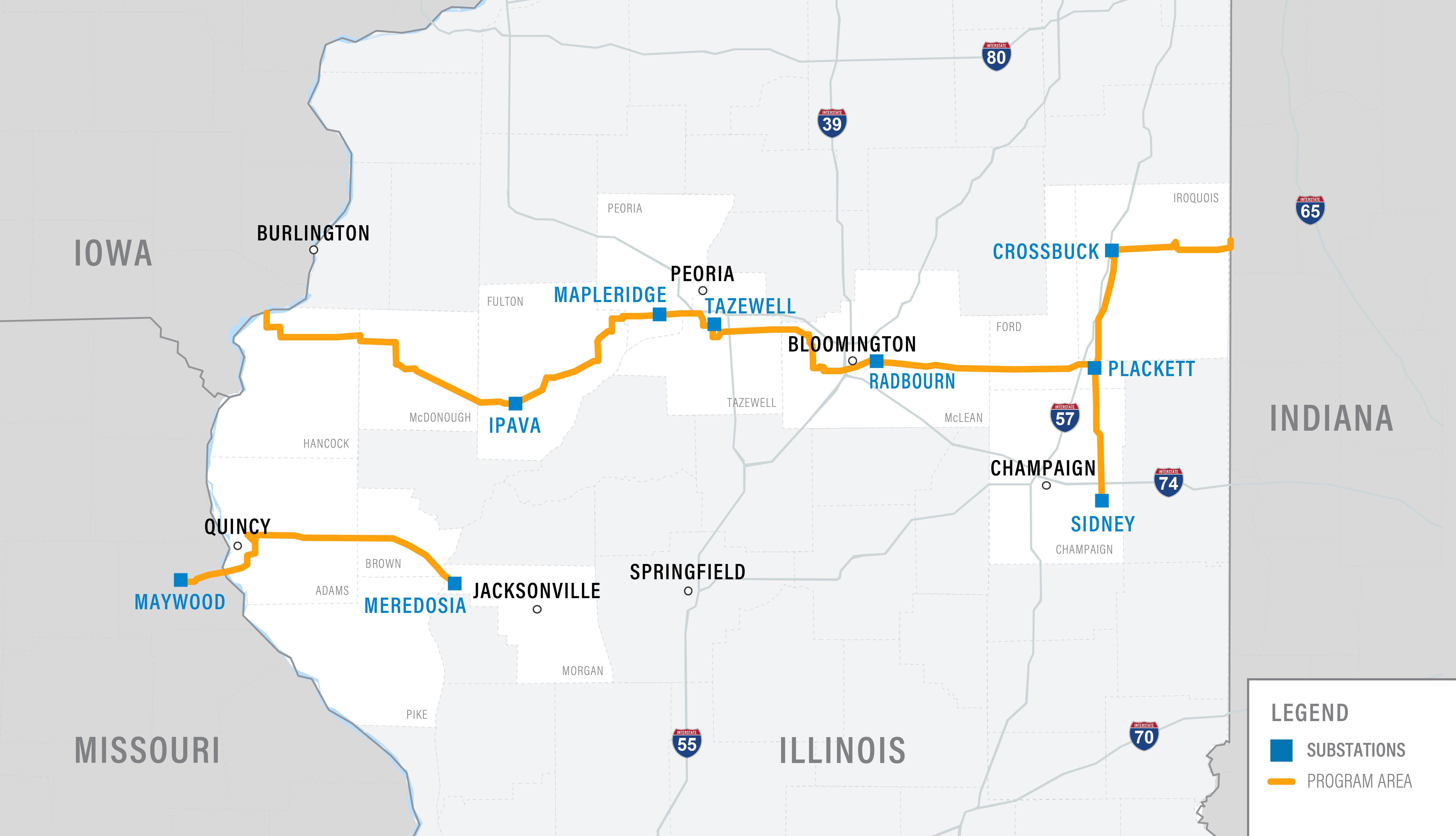
Tazewell County
Open House
Wednesday, October 11
11:00am - 1:00pm or 5:00pm - 7:00pm
Morton Knights of Columbus
Routing in Tazewell County
Listen to an update about what's happening in Tazewell County.
Hello! My name is Drew Beahm. I am one of the project managers for the Central Illinois Grid Transformation Program. We appreciate your interest in the program in Tazewell County. I’m sure you’re wondering what all the different lines on this map are for. Using our routing criteria, as well as input received from stakeholders and community members during phase 1 of public engagement, our team developed more defined routes or “Preliminary Route Alternatives”. We are sharing these preliminary route alternatives with the public to gather valuable input and feedback on the opportunities and sensitivities that will help our team in the routing process.
The colors on the map are different routes our team is exploring as part of the routing process. We will only be constructing one of these routes for the line. However, it is possible that the final routes could be combination of routes.
The yellow lines on the map are called connectors. Connectors are additional options the routing team is reviewing that could potentially be part of the final route. These connectors will only be used if they are selected as the final Preferred Route.
The dark green line on the map is an area where we will be constructing a new 138 kV single circuit, along existing transmission corridors. Constructing this new 138 kV circuit will allow an existing 138 kV circuit on existing transmission structures to be re-energized at a higher 345 kV voltage. Both the new 138 kV circuit, and the re-energized 345 kV circuit will be connected into the existing Tazewell substation. From this substation we have a three options.
The first option is to follow primarily an existing transmission corridor along the light green line, replacing existing 138 kV single circuit structures with double-circuit 345 kV and 138 kV structures.
The second option is to relocate the existing 138kV line– the light green line – and build a new, 138kV and 345kV circuit along the blue, orange, pink, or purple lines. A new 138kV line would be routed north along the yellow connector to the Mackinaw substation and then continue along the existing 138 kV route.
The third option is to construct a new 345 kV, single circuit line along the blue, orange, pink, or purple lines and to rebuild the existing 138 kV line along its existing corridor.
Now that you’ve learned more about what the colored lines mean, we encourage you to go back to the main map page and provide any feedback or input that would be helpful for our team to know during the routing process.

Click to enlarge
Download Mapbook (PDF) Routing Process Overview (PDF) What we Heard in Tazewell County (PDF)Overview
There are approximately 33 miles of new and upgraded transmission lines in Tazewell County.

Click to enlarge
Replace Wire and New Corridor
Replacing wire on 9 miles of existing lattice structures to carry additional energy. The existing 9-mile, 138 kV circuit will be rebuilt in a new corridor routed near the Illinois River.
Replacement or New Corridor
Replace 9 miles of existing wooden H-frame structures and steel monopoles with new steel monopoles OR route the new 9-mile, 345 kV circuit along new corridors instead of using existing corridors.
From there, we have two options to connect to McLean County
Option 1: Replacement
Continue with replacing 6 miles of existing steel monopole structures.
Option 2: New Corridor
Route the new 9 to 13-mile, 345 kV circuit along new corridors instead of using existing corridors.
Structure Snapshot
Click to enlarge.
McLean County
Open House
Thursday, October 12
11:00am - 1:00pm or 5:00pm - 7:00pm
Dale Township Building, Bloomington
Routing in McLean County
Listen to an update about what's happening in McLean County.
Hello! My name is Drew Beahm. I am one of the project managers for the Central Illinois Grid Transformation Program. We appreciate your interest in the program in McLean County. I’m sure you’re wondering what all the different lines on this map are for. Using our routing criteria, as well as input received from stakeholders and community members during phase 1 of public engagement, our team developed more defined routes or “Preliminary Route Alternatives”. We are sharing these preliminary route alternatives with the public to gather valuable input and feedback on the opportunities and sensitivities that will help our team in the routing process.
The colors on the map are different routes our team is exploring as part of the routing process. We will only be constructing one of these routes for the line. However, it is possible that the final routes could be combination of routes.
The yellow lines on the map are called connectors. Connectors are additional options the routing team is reviewing that could potentially be part of the final route. These connectors will only be used if they are selected as the final Preferred Route.
While nearly 85% of the Central Illinois Grid Transformation Program will be able to leverage existing transmission corridors for the construction of the new 345 kV circuits, in McLean County, the configuration of, and congestion along existing corridors requires that the project team investigate new transmission corridors.
Starting along the west side of the County, the various colored lines (pink, orange, light blue, and purple) represent the potential route alternatives for the new single-circuit 345 kV transmission circuit that will be routed south of the City of Bloomington. As the new circuit approaches a new substation located southeast of the Central Illinois Regional Airport, the blue and orange route alternative reflects a route alternative that will construct the new circuit parallel to existing transmission corridors.
From the new substation and heading to the eastern border of McLean County, the dark green line on the map represents an area where we plan to replace existing single circuit structures with new double-circuit structures.
Now that you’ve learned more about what the colored lines mean, we encourage you to go back to the main map page and provide any feedback or input that would be helpful for our team to know during the routing process.

Click to enlarge
Download Mapbook (PDF) Routing Process Overview (PDF) What we Heard in McLean County (PDF)Overview
There are approximately 50 miles of new and upgraded transmission lines in McLean County.

Click to enlarge
Option 1: Replacement and New Corridor
Replace 6 miles of existing steel monopoles with new steel monopoles in the existing transmission corridor. Then route the new 345 kV circuit approximately 20 miles along new corridors south of the City of Bloomington.
Option 2: New Corridor
Route the new, approximately 25-mile, 345 kV circuit south of the City of Bloomington instead of using existing corridors.
Replacement
Replacing 24 miles of existing wooden H-frame structures on the east side of Bloomington with new steel monopoles to carry additional energy. In most instances, the number of structures is lessened with a smaller footprint due to design and longer spans. New structures will typically be constructed within existing corridors.
Structure Snapshot
Click to enlarge.
Ford County
Open House
Wednesday, October 25
11:00am - 1:00pm or 5:00pm - 7:00pm
Kruse Event Center, Gibson City
Routing in Ford County
In general, we are following existing corridors in this area. The orange and blue lines near Paxton are options we are exploring instead of following the existing corridor.

Click to enlarge
Download Mapbook (PDF)Overview
There are approximately 27 miles of upgraded transmission lines in Ford County.

Click to enlarge
Replacement
Replacing 27 miles of existing wooden H-frame structures with new steel monopoles to carry additional energy. In most instances, the number of structures is lessened with a smaller footprint due to design and longer spans. New structures will typically be constructed within existing corridors.
Structure Snapshot
Click to enlarge.
Iroquois County
Open House
Thursday, October 26
11:00am - 1:00pm or 5:00pm - 7:00pm
Watseka Elks Lodge 1791
Routing in Iroquois County
In general, we are following existing corridors in this area. The orange and purple lines near Gilman and the orange and pink lines near Watseka are options we are exploring instead of following the existing corridors in these two areas.

Click to enlarge
Download Mapbook (PDF)Overview
There are approximately 50 miles of new or upgraded transmission lines in Iroquois County.

Click to enlarge
Replacement
Replacing 50 miles of existing wooden H-frame structures and wooden monopoles with new steel monopoles to carry additional energy. In most instances, the number of structures is lessened with a smaller footprint due to design and longer spans. New structures will typically be constructed within existing corridors. The exact connection point on the Illinois-Indiana border is still being considered, but will be within a few miles of the current corridor centerline.
New Corridor
The new 345 kV circuit may be routed in new corridors near existing substations in the cities of Gilman and Watseka.
Structure Snapshot
Click to enlarge.
Champaign County
Open House
Tuesday, October 24
11:00am - 1:00pm or 5:00pm - 7:00pm
Sidney Village Community Building, Sidney
Routing in Champaign County
In general, we are following existing corridors in this area. The orange and blue lines near Sidney are options we are exploring instead of following the existing corridor.

Click to enlarge
Download Mapbook (PDF)Overview
There are approximately 26 miles of upgraded transmission lines in Champaign County.

Click to enlarge
Replacement
Replacing 26 miles of existing wooden H-frame structures with new steel monopoles to carry additional energy. In most instances, the number of structures is lessened with a smaller footprint due to design and longer spans. New structures will typically be constructed within existing corridors.
Structure Snapshot

Click to enlarge.
Adams County
Open House
Tuesday, October 24
11:00am - 1:00pm or 5:00pm - 7:00pm
The Ambiance, Quincy, IL
Routing in Adams County
Listen to an update about what's happening in Adams County.
Hello! My name is Drew Beahm. I am one of the project managers for the Central Illinois Grid Transformation Program. We appreciate your interest in the program in Adams County. I’m sure you’re wondering what all the different lines on this map are for. Using our routing criteria, as well as input received from stakeholders and community members during phase 1 of public engagement, our team developed more defined routes or “Preliminary Route Alternatives”. We are sharing these preliminary route alternatives with the public to gather valuable input and feedback on the opportunities and sensitivities that will help our team in the routing process.
The colors on the map are different routes our team is exploring as part of the routing process. We will only be constructing one of these routes for the line. However, it is possible that the final routes could be combination of routes.
The dark green lines on the map are areas that following existing transmission corridors, where we will be, primarily, replacing existing single-circuit structures with new double-circuit structures to accommodate installation of the new 345 kV circuit.
The new 345 kV circuit will enter Adams County southwest of Quincy utilizing existing river crossing structures to cross the Mississippi River. The circuit will be routed along those existing transmission corridors to the south and east of Quincy along the dark green lines mentioned previously. As the circuit continues north parallel to Highway 172, the configuration of, and congestion along the existing transmission corridors require the team to consider new transmission corridors.
The first of the options will continue rebuild of the existing single-circuit transmission lines along the light green line in a double-circuit 345/138 kV configuration.
The second option will construct the new 345 kV circuit in a new corridor, represented by the orange, light blue, or purple lines. In this option, the existing single circuit 138 kV lines will be rebuilt in their existing corridors.
A third option may consider constructing the new corridors with double-circuit structures and relocating portions of the existing 138 kV circuits along those new corridors shown in orange, light blue, and purple.
Regardless of option chosen, as the new circuit progresses towards the east of Adams County, it will connect back up with the existing 138 kV single circuit line shown in dark green. This portion of the line will be rebuilt, replacing existing single-circuit H-frame structures with double circuit steel monopole structures to carry both the new 345 kV and existing 138 kV circuits.
Now that you’ve learned more about what the colored lines mean, we encourage you to go back to the main map page and provide any feedback or input that would be helpful for our team to know during the routing process.

Click to enlarge
Download Mapbook (PDF) Routing Process Overview (PDF) What we Heard in Adams County (PDF)Overview
There are approximately 40 miles of new or upgraded transmission lines in Adams County.

Click to enlarge
Replacement
Replacing 40 miles of existing lattice structures and wooden H-frame structures with new steel monopoles to carry additional energy.In most instances, the number of structures is lessened with a smaller footprint due to design and longer spans. New structures will typically be constructed within existing corridors.
New Corridor
Possibility of new 345 kV circuit being routed in new corridors near Quincy.
Structure Snapshot

Click to enlarge.
Brown County
Open House
Wednesday, October 25
11:00am - 1:00pm or 5:00pm - 7:00pm
Mt. Sterling Knights of Columbus Hall
Routing in Brown County
In general, we are following existing corridors in this area. The orange and purple lines near Pike County are options we are exploring to cross the river instead of following the existing corridor.

Click to enlarge
Download Mapbook (PDF)Overview
There are approximately 20 miles of upgraded transmission lines in Brown County.

Click to enlarge
Replacement
Replacing existing wooden H-frame structures with new steel monopoles to carry additional energy. There are approximately 20 miles in Brown County, 2 miles in Pike County and 1 mile in Morgan County of new or upgraded transmission lines. In most instances, the number of structures is lessened with a smaller footprint due to design and longer spans. New structures will typically be constructed within existing corridors.
New Corridor
The new 345 kV circuit will be constructed in new corridors to connect separate existing transmission corridors to utilize existing structures to cross the Illinois River. New corridors may be utilized to route the new 345 kV circuit near an existing substation in the village of Meredosia.
Structure Snapshot
Click to enlarge.
Pike County
Open House
Thursday, October 26
11:00am - 1:00pm or 5:00pm - 7:00pm
Meredosia American Legion Post 516
Routing in Pike County
In general, we are following existing corridors in this area. The orange and purple lines are options we are exploring to cross the river instead of following the existing corridor.

Click to enlarge
Download Mapbook (PDF)Overview
There are approximately 2 miles in Pike County of new or upgraded transmission lines.
Click to enlarge
Replacement
Replacing existing wooden H-frame structures with new steel monopoles to carry additional energy. There are approximately 20 miles in Brown County, 2 miles in Pike County and 1 mile in Morgan County of new or upgraded transmission lines. In most instances, the number of structures is lessened with a smaller footprint due to design and longer spans. New structures will typically be constructed within existing corridors.
New Corridor
The new 345 kV circuit will be constructed in new corridors to connect separate existing transmission corridors to utilize existing structures to cross the Illinois River. New corridors may be utilized to route the new 345 kV circuit near an existing substation in the village of Meredosia.
Structure Snapshot
Click to enlarge.
Morgan County
Open House
Thursday, October 26
11:00am - 1:00pm or 5:00pm - 7:00pm
Meredosia American Legion Post 516
Routing in Morgan County
In general, we are following existing corridors in this area. The orange and purple lines are options we are exploring to cross the river instead of following the existing corridor.

Click to enlarge
Download Mapbook (PDF)Overview
There is approximately 1 mile in Morgan County of new or upgraded transmission lines.
Click to enlarge
Replacement
Replacing existing wooden H-frame structures with new steel monopoles to carry additional energy. There are approximately 20 miles in Brown County, 2 miles in Pike County and 1 mile in Morgan County of new or upgraded transmission lines. In most instances, the number of structures is lessened with a smaller footprint due to design and longer spans. New structures will typically be constructed within existing corridors.
New Corridor
The new 345 kV circuit will be constructed in new corridors to connect separate existing transmission corridors to utilize existing structures to cross the Illinois River. New corridors may be utilized to route the new 345 kV circuit near an existing substation in the village of Meredosia.
Structure Snapshot
Click to enlarge.
Thank You
Your comment is under review and will be added to the map when it's approved.


Engagement Series 2 - October 2023
We appreciate the active participation and input provided by community members and stakeholders throughout the first series of engagement in August 2023. All input received was reviewed and considered for the development of our second round of engagement.
The colors on the main map of this virtual engagement are different routes our team is exploring as part of the routing process. We are sharing these preliminary route alternatives with the public to gather valuable input and feedback on the opportunities and sensitivities that will help our team in the routing process.
Explore the virtual engagement to see how our routing process has progressed and review and comment on the updated maps.
 Click on the series of icons along the left side to learn more about the program
- Click on your county on the map to see what's happening in your area
- Leave a comment on the interactive map to provide your feedback to the program team